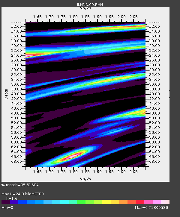
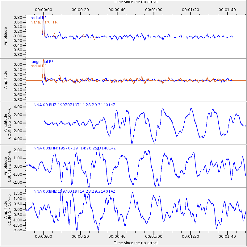
NNA Nana, Peru - Earthquake Result Viewer

Earthquake location: Near Coast Of Guerrero, Mexico
Earthquake latitude/longitude: 16.3/-98.2
Earthquake time(UTC): 1997/07/19 (200) 14:22:08 GMT
Earthquake Depth: 33 km
Earthquake Magnitude: 5.7 MB, 6.3 MS, 6.8 UNKNOWN, 6.0 ME
Earthquake Catalog/Contributor: WHDF/NEIC
Network: II Global Seismograph Network (GSN - IRIS/IDA)
Station: NNA Nana, Peru
Lat/Lon: 11.99 S/76.84 W
Elevation: 575 m
Distance: 35.2 deg
Az: 141.778 deg
Baz: 322.618 deg
Ray Param: 0.07729116
Estimated Moho Depth: 24.0 km
Estimated Crust Vp/Vs: 1.60
Assumed Crust Vp: 6.472 km/s
Estimated Crust Vs: 4.045 km/s
Estimated Crust Poisson's Ratio: 0.18
Radial Match: 95.51604 %
Radial Bump: 400
Transverse Match: 68.791824 %
Transverse Bump: 400
SOD ConfigId: 6273
Insert Time: 2010-03-01 19:50:37.247 +0000
GWidth: 2.5
Max Bumps: 400
Tol: 0.001

Signal To Noise

ChannelStoNSTALTA
II:NNA:00:BHN:19970719T14:28:29.314014Z1.9885324.6245484E-72.3256092E-7
II:NNA:00:BHE:19970719T14:28:29.314014Z1.07699013.213539E-72.9838145E-7
II:NNA:00:BHZ:19970719T14:28:29.314014Z2.9254939.473236E-73.2381672E-7
Arrivals
Ps2.4 SECOND
PpPs8.8 SECOND
PsPs/PpSs11 SECOND