NNA Nana, Peru - Earthquake Result Viewer
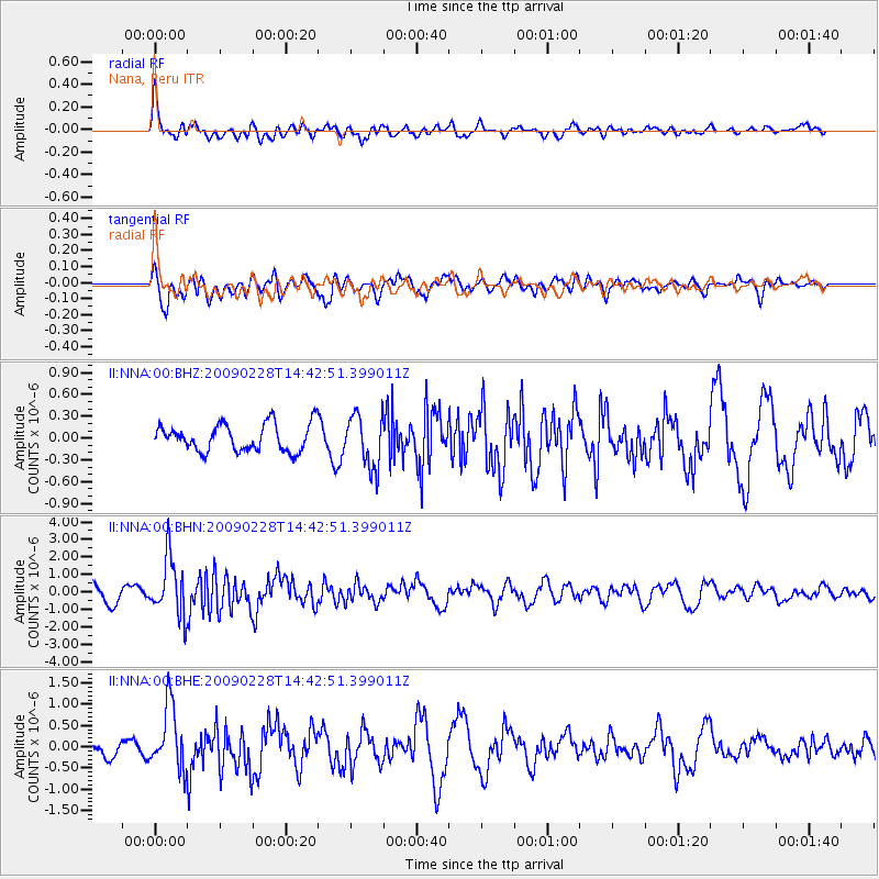
Earthquake location: South Sandwich Islands Region
Earthquake latitude/longitude: -60.5/-24.8
Earthquake time(UTC): 2009/02/28 (059) 14:33:06 GMT
Earthquake Depth: 15 km
Earthquake Magnitude: 6.1 MB, 6.1 MS, 6.3 MW, 6.3 MW
Earthquake Catalog/Contributor: WHDF/NEIC
Network: II Global Seismograph Network (GSN - IRIS/IDA)
Station: NNA Nana, Peru
Lat/Lon: 11.99 S/76.84 W
Elevation: 575 m
Distance: 61.5 deg
Az: 298.619 deg
Baz: 153.661 deg
Ray Param: 0.060815573
Estimated Moho Depth: 58.25 km
Estimated Crust Vp/Vs: 1.65
Assumed Crust Vp: 6.472 km/s
Estimated Crust Vs: 3.916 km/s
Estimated Crust Poisson's Ratio: 0.21
Radial Match: 82.07142 %
Radial Bump: 400
Transverse Match: 67.7716 %
Transverse Bump: 400
SOD ConfigId: 2658
Insert Time: 2010-03-01 19:50:49.198 +0000
GWidth: 2.5
Max Bumps: 400
Tol: 0.001

Signal To Noise

ChannelStoNSTALTA
II:NNA:00:BHN:20090228T14:42:51.399011Z3.33665251.6642047E-64.9876473E-7
II:NNA:00:BHE:20090228T14:42:51.399011Z5.73073157.477437E-71.3047962E-7
II:NNA:00:BHZ:20090228T14:42:51.399011Z1.95808833.638524E-71.8582021E-7
Arrivals
Ps6.2 SECOND
PpPs23 SECOND
PsPs/PpSs29 SECOND