You are here: Home > Network List > TA - USArray Transportable Network (new EarthScope stations) Stations List
> Station X59A McDuffie Farm, Elizabethtown, NC, USA > Earthquake Result Viewer
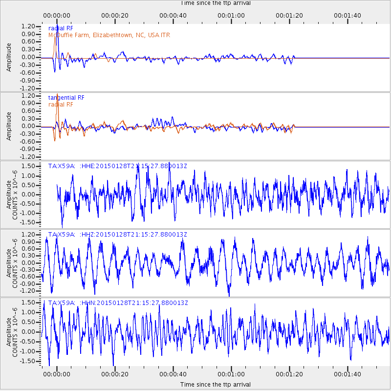
X59A McDuffie Farm, Elizabethtown, NC, USA - Earthquake Result Viewer
*The percent match for this event was below the threshold and hence no stack was calculated.
| Earthquake location: |
Near Coast Of Northern Calif. |
| Earthquake latitude/longitude: |
40.3/-124.6 |
| Earthquake time(UTC): |
2015/01/28 (028) 21:08:53 GMT |
| Earthquake Depth: |
17 km |
| Earthquake Magnitude: |
5.7 MWW, 5.7 MWR, 5.7 MWB, 5.8 MWC |
| Earthquake Catalog/Contributor: |
NEIC PDE/NEIC COMCAT |
|
| Network: |
TA USArray Transportable Network (new EarthScope stations) |
| Station: |
X59A McDuffie Farm, Elizabethtown, NC, USA |
| Lat/Lon: |
34.57 N/78.60 W |
| Elevation: |
29 m |
|
| Distance: |
36.6 deg |
| Az: |
83.992 deg |
| Baz: |
292.855 deg |
| Ray Param: |
$rayparam |
*The percent match for this event was below the threshold and hence was not used in the summary stack. |
|
| Radial Match: |
66.53526 % |
| Radial Bump: |
400 |
| Transverse Match: |
52.71359 % |
| Transverse Bump: |
400 |
| SOD ConfigId: |
3390531 |
| Insert Time: |
2019-04-16 05:12:36.973 +0000 |
| GWidth: |
2.5 |
| Max Bumps: |
400 |
| Tol: |
0.001 |
|
Signal To Noise
| Channel | StoN | STA | LTA |
| TA:X59A: :HHZ:20150128T21:15:27.880013Z | 1.3393966 | 4.7009817E-7 | 3.509776E-7 |
| TA:X59A: :HHN:20150128T21:15:27.880013Z | 1.5231038 | 6.6280285E-7 | 4.351659E-7 |
| TA:X59A: :HHE:20150128T21:15:27.880013Z | 1.4953979 | 6.8749154E-7 | 4.597382E-7 |
| Arrivals |
| Ps | |
| PpPs | |
| PsPs/PpSs | |


