You are here: Home > Network List > CI - Caltech Regional Seismic Network Stations List
> Station SWS Sam W. Stewart, Westmorland, CA, USA > Earthquake Result Viewer
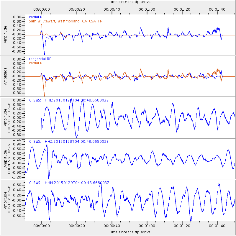
SWS Sam W. Stewart, Westmorland, CA, USA - Earthquake Result Viewer
*The percent match for this event was below the threshold and hence no stack was calculated.
| Earthquake location: |
Tonga Islands |
| Earthquake latitude/longitude: |
-19.3/-174.2 |
| Earthquake time(UTC): |
2015/01/29 (029) 03:49:34 GMT |
| Earthquake Depth: |
30 km |
| Earthquake Magnitude: |
5.5 MW, 5.2 mb, 5.0 MS |
| Earthquake Catalog/Contributor: |
ISC/ISC |
|
| Network: |
CI Caltech Regional Seismic Network |
| Station: |
SWS Sam W. Stewart, Westmorland, CA, USA |
| Lat/Lon: |
32.94 N/115.80 W |
| Elevation: |
140 m |
|
| Distance: |
76.2 deg |
| Az: |
47.488 deg |
| Baz: |
235.868 deg |
| Ray Param: |
$rayparam |
*The percent match for this event was below the threshold and hence was not used in the summary stack. |
|
| Radial Match: |
74.76799 % |
| Radial Bump: |
400 |
| Transverse Match: |
62.857204 % |
| Transverse Bump: |
400 |
| SOD ConfigId: |
3390531 |
| Insert Time: |
2019-04-16 05:25:47.602 +0000 |
| GWidth: |
2.5 |
| Max Bumps: |
400 |
| Tol: |
0.001 |
|
Signal To Noise
| Channel | StoN | STA | LTA |
| CI:SWS: :HHZ:20150129T04:00:48.668003Z | 1.5742167 | 6.3851735E-7 | 4.0560957E-7 |
| CI:SWS: :HHN:20150129T04:00:48.668003Z | 0.86598593 | 2.6911707E-7 | 3.1076377E-7 |
| CI:SWS: :HHE:20150129T04:00:48.668003Z | 0.6985032 | 3.4112796E-7 | 4.8836995E-7 |
| Arrivals |
| Ps | |
| PpPs | |
| PsPs/PpSs | |


