You are here: Home > Network List > TA - USArray Transportable Network (new EarthScope stations) Stations List
> Station L04D Klamath Falls, OR, USA > Earthquake Result Viewer
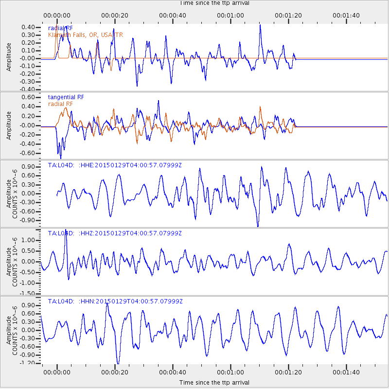
L04D Klamath Falls, OR, USA - Earthquake Result Viewer
*The percent match for this event was below the threshold and hence no stack was calculated.
| Earthquake location: |
Tonga Islands |
| Earthquake latitude/longitude: |
-19.3/-174.2 |
| Earthquake time(UTC): |
2015/01/29 (029) 03:49:34 GMT |
| Earthquake Depth: |
30 km |
| Earthquake Magnitude: |
5.5 MW, 5.2 mb, 5.0 MS |
| Earthquake Catalog/Contributor: |
ISC/ISC |
|
| Network: |
TA USArray Transportable Network (new EarthScope stations) |
| Station: |
L04D Klamath Falls, OR, USA |
| Lat/Lon: |
42.22 N/122.30 W |
| Elevation: |
1437 m |
|
| Distance: |
77.7 deg |
| Az: |
36.716 deg |
| Baz: |
229.462 deg |
| Ray Param: |
$rayparam |
*The percent match for this event was below the threshold and hence was not used in the summary stack. |
|
| Radial Match: |
58.271656 % |
| Radial Bump: |
400 |
| Transverse Match: |
62.45126 % |
| Transverse Bump: |
385 |
| SOD ConfigId: |
3390531 |
| Insert Time: |
2019-04-16 05:28:47.343 +0000 |
| GWidth: |
2.5 |
| Max Bumps: |
400 |
| Tol: |
0.001 |
|
Signal To Noise
| Channel | StoN | STA | LTA |
| TA:L04D: :HHZ:20150129T04:00:57.07999Z | 3.646481 | 5.810381E-7 | 1.5934214E-7 |
| TA:L04D: :HHN:20150129T04:00:57.07999Z | 0.5353778 | 2.2936494E-7 | 4.28417E-7 |
| TA:L04D: :HHE:20150129T04:00:57.07999Z | 0.7107957 | 2.2262257E-7 | 3.1320192E-7 |
| Arrivals |
| Ps | |
| PpPs | |
| PsPs/PpSs | |


