You are here: Home > Network List > TA - USArray Transportable Network (new EarthScope stations) Stations List
> Station MSTX Muleshoe, TX, USA > Earthquake Result Viewer
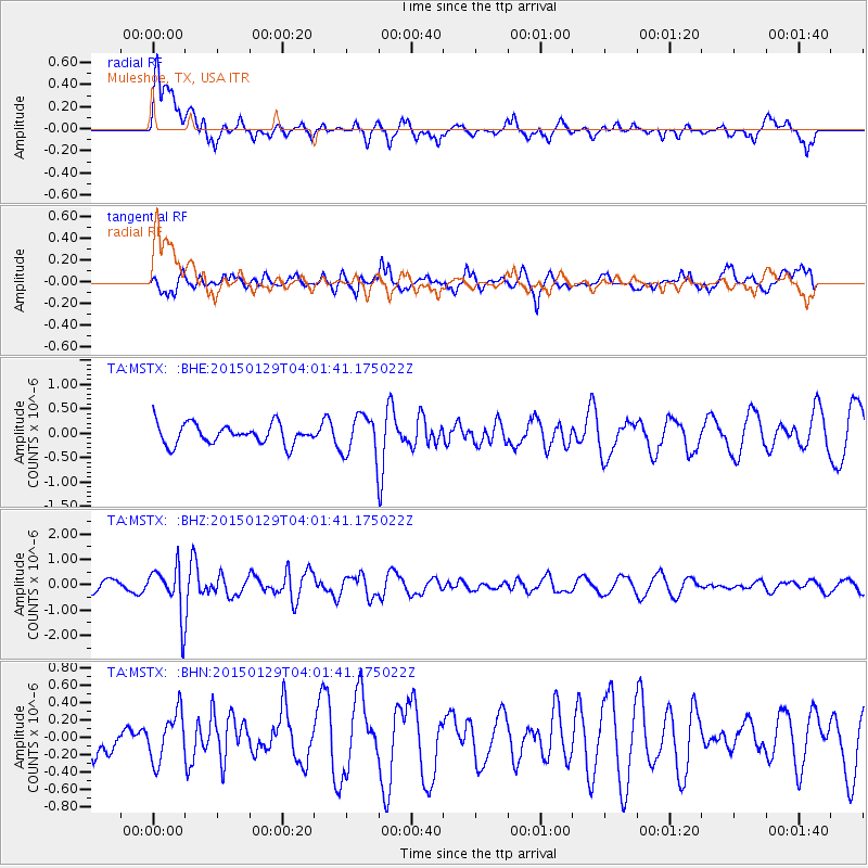
MSTX Muleshoe, TX, USA - Earthquake Result Viewer
*The percent match for this event was below the threshold and hence no stack was calculated.
| Earthquake location: |
Tonga Islands |
| Earthquake latitude/longitude: |
-19.3/-174.2 |
| Earthquake time(UTC): |
2015/01/29 (029) 03:49:34 GMT |
| Earthquake Depth: |
30 km |
| Earthquake Magnitude: |
5.5 MW, 5.2 mb, 5.0 MS |
| Earthquake Catalog/Contributor: |
ISC/ISC |
|
| Network: |
TA USArray Transportable Network (new EarthScope stations) |
| Station: |
MSTX Muleshoe, TX, USA |
| Lat/Lon: |
33.97 N/102.77 W |
| Elevation: |
1167 m |
|
| Distance: |
86.1 deg |
| Az: |
52.126 deg |
| Baz: |
243.751 deg |
| Ray Param: |
$rayparam |
*The percent match for this event was below the threshold and hence was not used in the summary stack. |
|
| Radial Match: |
61.69984 % |
| Radial Bump: |
400 |
| Transverse Match: |
59.81131 % |
| Transverse Bump: |
370 |
| SOD ConfigId: |
3390531 |
| Insert Time: |
2019-04-16 05:28:49.027 +0000 |
| GWidth: |
2.5 |
| Max Bumps: |
400 |
| Tol: |
0.001 |
|
Signal To Noise
| Channel | StoN | STA | LTA |
| TA:MSTX: :BHZ:20150129T04:01:41.175022Z | 3.5214071 | 9.669892E-7 | 2.7460305E-7 |
| TA:MSTX: :BHN:20150129T04:01:41.175022Z | 0.8693944 | 2.8571156E-7 | 3.2863284E-7 |
| TA:MSTX: :BHE:20150129T04:01:41.175022Z | 1.9981052 | 4.09017E-7 | 2.0470245E-7 |
| Arrivals |
| Ps | |
| PpPs | |
| PsPs/PpSs | |


