You are here: Home > Network List > TA - USArray Transportable Network (new EarthScope stations) Stations List
> Station O03E Paynes Creek, CA, USA > Earthquake Result Viewer
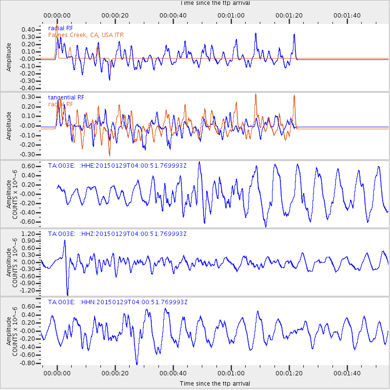
O03E Paynes Creek, CA, USA - Earthquake Result Viewer
*The percent match for this event was below the threshold and hence no stack was calculated.
| Earthquake location: |
Tonga Islands |
| Earthquake latitude/longitude: |
-19.3/-174.2 |
| Earthquake time(UTC): |
2015/01/29 (029) 03:49:34 GMT |
| Earthquake Depth: |
30 km |
| Earthquake Magnitude: |
5.5 MW, 5.2 mb, 5.0 MS |
| Earthquake Catalog/Contributor: |
ISC/ISC |
|
| Network: |
TA USArray Transportable Network (new EarthScope stations) |
| Station: |
O03E Paynes Creek, CA, USA |
| Lat/Lon: |
40.29 N/121.80 W |
| Elevation: |
967 m |
|
| Distance: |
76.8 deg |
| Az: |
38.472 deg |
| Baz: |
230.18 deg |
| Ray Param: |
$rayparam |
*The percent match for this event was below the threshold and hence was not used in the summary stack. |
|
| Radial Match: |
58.46424 % |
| Radial Bump: |
359 |
| Transverse Match: |
35.245216 % |
| Transverse Bump: |
278 |
| SOD ConfigId: |
3390531 |
| Insert Time: |
2019-04-16 05:28:50.906 +0000 |
| GWidth: |
2.5 |
| Max Bumps: |
400 |
| Tol: |
0.001 |
|
Signal To Noise
| Channel | StoN | STA | LTA |
| TA:O03E: :HHZ:20150129T04:00:51.769993Z | 2.9623494 | 5.3888704E-7 | 1.8191204E-7 |
| TA:O03E: :HHN:20150129T04:00:51.769993Z | 1.0683649 | 1.9688831E-7 | 1.8428939E-7 |
| TA:O03E: :HHE:20150129T04:00:51.769993Z | 1.4045749 | 1.906437E-7 | 1.3573055E-7 |
| Arrivals |
| Ps | |
| PpPs | |
| PsPs/PpSs | |


