You are here: Home > Network List > US - United States National Seismic Network Stations List
> Station MNTX Cornudas Mountains, Texas, USA > Earthquake Result Viewer
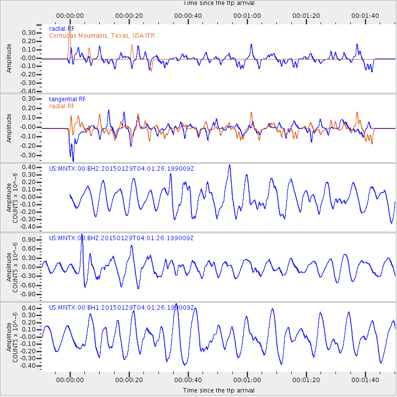
MNTX Cornudas Mountains, Texas, USA - Earthquake Result Viewer
*The percent match for this event was below the threshold and hence no stack was calculated.
| Earthquake location: |
Tonga Islands |
| Earthquake latitude/longitude: |
-19.3/-174.2 |
| Earthquake time(UTC): |
2015/01/29 (029) 03:49:34 GMT |
| Earthquake Depth: |
30 km |
| Earthquake Magnitude: |
5.5 MW, 5.2 mb, 5.0 MS |
| Earthquake Catalog/Contributor: |
ISC/ISC |
|
| Network: |
US United States National Seismic Network |
| Station: |
MNTX Cornudas Mountains, Texas, USA |
| Lat/Lon: |
31.70 N/105.38 W |
| Elevation: |
404 m |
|
| Distance: |
83.1 deg |
| Az: |
53.156 deg |
| Baz: |
242.439 deg |
| Ray Param: |
$rayparam |
*The percent match for this event was below the threshold and hence was not used in the summary stack. |
|
| Radial Match: |
50.75313 % |
| Radial Bump: |
400 |
| Transverse Match: |
56.45312 % |
| Transverse Bump: |
380 |
| SOD ConfigId: |
3390531 |
| Insert Time: |
2019-04-16 05:29:29.407 +0000 |
| GWidth: |
2.5 |
| Max Bumps: |
400 |
| Tol: |
0.001 |
|
Signal To Noise
| Channel | StoN | STA | LTA |
| US:MNTX:00:BHZ:20150129T04:01:26.199009Z | 2.2618425 | 3.5755227E-7 | 1.5808008E-7 |
| US:MNTX:00:BH1:20150129T04:01:26.199009Z | 1.0514317 | 1.1635998E-7 | 1.1066813E-7 |
| US:MNTX:00:BH2:20150129T04:01:26.199009Z | 1.075893 | 1.4144902E-7 | 1.3147125E-7 |
| Arrivals |
| Ps | |
| PpPs | |
| PsPs/PpSs | |


