You are here: Home > Network List > GS - US Geological Survey Networks Stations List
> Station KAN10 Keim Farm > Earthquake Result Viewer
KAN10 Keim Farm - Earthquake Result Viewer
*The percent match for this event was below the threshold and hence no stack was calculated.
| Earthquake location: |
Kuril Islands |
| Earthquake latitude/longitude: |
49.4/156.4 |
| Earthquake time(UTC): |
2015/01/30 (030) 04:30:37 GMT |
| Earthquake Depth: |
46 km |
| Earthquake Magnitude: |
5.2 MW, 5.0 mb, 4.7 MS |
| Earthquake Catalog/Contributor: |
ISC/ISC |
|
| Network: |
GS US Geological Survey Networks |
| Station: |
KAN10 Keim Farm |
| Lat/Lon: |
37.12 N/98.10 W |
| Elevation: |
417 m |
|
| Distance: |
71.6 deg |
| Az: |
54.269 deg |
| Baz: |
318.393 deg |
| Ray Param: |
$rayparam |
*The percent match for this event was below the threshold and hence was not used in the summary stack. |
|
| Radial Match: |
39.996513 % |
| Radial Bump: |
400 |
| Transverse Match: |
35.172153 % |
| Transverse Bump: |
400 |
| SOD ConfigId: |
3390531 |
| Insert Time: |
2019-04-16 05:35:19.806 +0000 |
| GWidth: |
2.5 |
| Max Bumps: |
400 |
| Tol: |
0.001 |
|
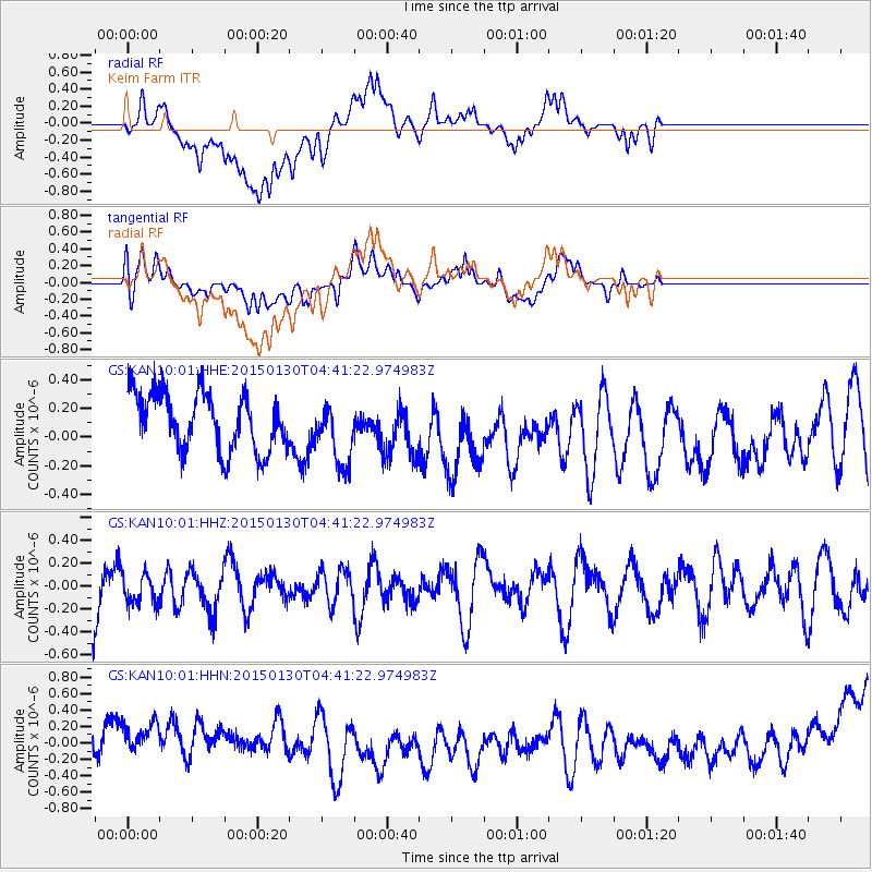
Signal To Noise
| Channel | StoN | STA | LTA |
| GS:KAN10:01:HHZ:20150130T04:41:22.974983Z | 0.6049169 | 1.3117258E-7 | 2.1684399E-7 |
| GS:KAN10:01:HHN:20150130T04:41:22.974983Z | 1.0471574 | 2.0018052E-7 | 1.9116565E-7 |
| GS:KAN10:01:HHE:20150130T04:41:22.974983Z | 1.1402857 | 2.2862434E-7 | 2.0049742E-7 |
| Arrivals |
| Ps | |
| PpPs | |
| PsPs/PpSs | |


