You are here: Home > Network List > TA - USArray Transportable Network (new EarthScope stations) Stations List
> Station O03E Paynes Creek, CA, USA > Earthquake Result Viewer
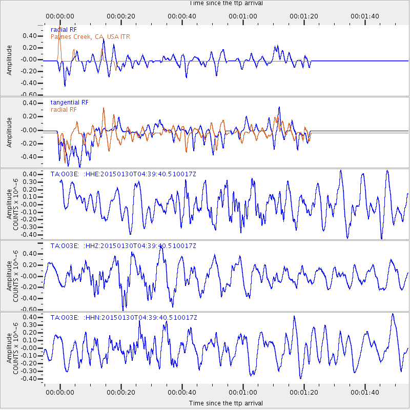
O03E Paynes Creek, CA, USA - Earthquake Result Viewer
*The percent match for this event was below the threshold and hence no stack was calculated.
| Earthquake location: |
Kuril Islands |
| Earthquake latitude/longitude: |
49.4/156.4 |
| Earthquake time(UTC): |
2015/01/30 (030) 04:30:37 GMT |
| Earthquake Depth: |
46 km |
| Earthquake Magnitude: |
5.2 MW, 5.0 mb, 4.7 MS |
| Earthquake Catalog/Contributor: |
ISC/ISC |
|
| Network: |
TA USArray Transportable Network (new EarthScope stations) |
| Station: |
O03E Paynes Creek, CA, USA |
| Lat/Lon: |
40.29 N/121.80 W |
| Elevation: |
967 m |
|
| Distance: |
56.0 deg |
| Az: |
65.925 deg |
| Baz: |
308.7 deg |
| Ray Param: |
$rayparam |
*The percent match for this event was below the threshold and hence was not used in the summary stack. |
|
| Radial Match: |
67.70138 % |
| Radial Bump: |
400 |
| Transverse Match: |
58.84222 % |
| Transverse Bump: |
400 |
| SOD ConfigId: |
3390531 |
| Insert Time: |
2019-04-16 05:39:01.005 +0000 |
| GWidth: |
2.5 |
| Max Bumps: |
400 |
| Tol: |
0.001 |
|
Signal To Noise
| Channel | StoN | STA | LTA |
| TA:O03E: :HHZ:20150130T04:39:40.510017Z | 0.5269598 | 1.0942719E-7 | 2.0765758E-7 |
| TA:O03E: :HHN:20150130T04:39:40.510017Z | 0.75099194 | 2.1283698E-7 | 2.8340781E-7 |
| TA:O03E: :HHE:20150130T04:39:40.510017Z | 0.72959936 | 1.1858547E-7 | 1.6253506E-7 |
| Arrivals |
| Ps | |
| PpPs | |
| PsPs/PpSs | |


