You are here: Home > Network List > US - United States National Seismic Network Stations List
> Station HAWA Hanford, Washington, USA > Earthquake Result Viewer
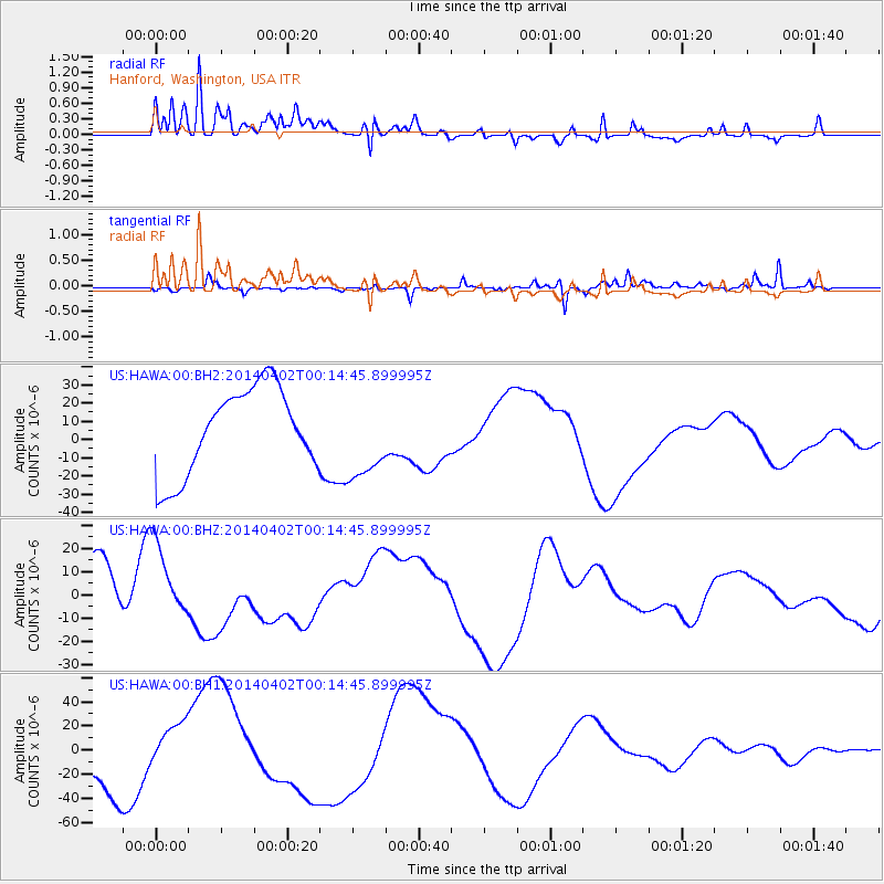
HAWA Hanford, Washington, USA - Earthquake Result Viewer
*The percent match for this event was below the threshold and hence no stack was calculated.
| Earthquake location: |
Near Coast Of Northern Chile |
| Earthquake latitude/longitude: |
-19.8/-70.9 |
| Earthquake time(UTC): |
2014/04/02 (092) 00:03:12 GMT |
| Earthquake Depth: |
10 km |
| Earthquake Magnitude: |
5.8 MB |
| Earthquake Catalog/Contributor: |
NEIC PDE/NEIC COMCAT |
|
| Network: |
US United States National Seismic Network |
| Station: |
HAWA Hanford, Washington, USA |
| Lat/Lon: |
46.39 N/119.53 W |
| Elevation: |
364 m |
|
| Distance: |
79.2 deg |
| Az: |
328.065 deg |
| Baz: |
133.995 deg |
| Ray Param: |
$rayparam |
*The percent match for this event was below the threshold and hence was not used in the summary stack. |
|
| Radial Match: |
67.45907 % |
| Radial Bump: |
400 |
| Transverse Match: |
28.930176 % |
| Transverse Bump: |
224 |
| SOD ConfigId: |
626651 |
| Insert Time: |
2014-04-21 22:24:31.071 +0000 |
| GWidth: |
2.5 |
| Max Bumps: |
400 |
| Tol: |
0.001 |
|
Signal To Noise
| Channel | StoN | STA | LTA |
| US:HAWA:00:BHZ:20140402T00:14:45.899995Z | 1.8062116 | 1.6237582E-5 | 8.989857E-6 |
| US:HAWA:00:BH1:20140402T00:14:45.899995Z | 0.80620974 | 2.1643113E-5 | 2.6845513E-5 |
| US:HAWA:00:BH2:20140402T00:14:45.899995Z | 0.98689574 | 2.315909E-5 | 2.3466602E-5 |
| Arrivals |
| Ps | |
| PpPs | |
| PsPs/PpSs | |


