You are here: Home > Network List > TA - USArray Transportable Network (new EarthScope stations) Stations List
> Station I45A Fountain, MI, USA > Earthquake Result Viewer
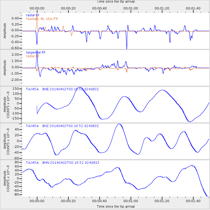
I45A Fountain, MI, USA - Earthquake Result Viewer
*The percent match for this event was below the threshold and hence no stack was calculated.
| Earthquake location: |
Near Coast Of Northern Chile |
| Earthquake latitude/longitude: |
-19.6/-70.8 |
| Earthquake time(UTC): |
2014/04/02 (092) 00:06:44 GMT |
| Earthquake Depth: |
10 km |
| Earthquake Magnitude: |
5.7 MB |
| Earthquake Catalog/Contributor: |
NEIC PDE/NEIC COMCAT |
|
| Network: |
TA USArray Transportable Network (new EarthScope stations) |
| Station: |
I45A Fountain, MI, USA |
| Lat/Lon: |
44.04 N/86.23 W |
| Elevation: |
215 m |
|
| Distance: |
64.9 deg |
| Az: |
347.77 deg |
| Baz: |
163.928 deg |
| Ray Param: |
$rayparam |
*The percent match for this event was below the threshold and hence was not used in the summary stack. |
|
| Radial Match: |
55.38617 % |
| Radial Bump: |
279 |
| Transverse Match: |
27.776924 % |
| Transverse Bump: |
400 |
| SOD ConfigId: |
626651 |
| Insert Time: |
2014-04-21 23:02:06.956 +0000 |
| GWidth: |
2.5 |
| Max Bumps: |
400 |
| Tol: |
0.001 |
|
Signal To Noise
| Channel | StoN | STA | LTA |
| TA:I45A: :BHZ:20140402T00:16:52.924983Z | 3.1455579 | 3.1835272E-5 | 1.0120707E-5 |
| TA:I45A: :BHN:20140402T00:16:52.924983Z | 0.15573294 | 6.26644E-6 | 4.0238374E-5 |
| TA:I45A: :BHE:20140402T00:16:52.924983Z | 2.6930373 | 1.15119845E-4 | 4.2747215E-5 |
| Arrivals |
| Ps | |
| PpPs | |
| PsPs/PpSs | |


