You are here: Home > Network List > TA - USArray Transportable Network (new EarthScope stations) Stations List
> Station W59A Clinton, NC, USA > Earthquake Result Viewer
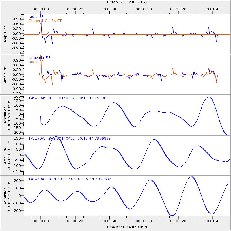
W59A Clinton, NC, USA - Earthquake Result Viewer
*The percent match for this event was below the threshold and hence no stack was calculated.
| Earthquake location: |
Near Coast Of Northern Chile |
| Earthquake latitude/longitude: |
-19.6/-70.8 |
| Earthquake time(UTC): |
2014/04/02 (092) 00:06:44 GMT |
| Earthquake Depth: |
10 km |
| Earthquake Magnitude: |
5.7 MB |
| Earthquake Catalog/Contributor: |
NEIC PDE/NEIC COMCAT |
|
| Network: |
TA USArray Transportable Network (new EarthScope stations) |
| Station: |
W59A Clinton, NC, USA |
| Lat/Lon: |
35.17 N/78.44 W |
| Elevation: |
60 m |
|
| Distance: |
55.0 deg |
| Az: |
352.362 deg |
| Baz: |
171.204 deg |
| Ray Param: |
$rayparam |
*The percent match for this event was below the threshold and hence was not used in the summary stack. |
|
| Radial Match: |
52.27329 % |
| Radial Bump: |
321 |
| Transverse Match: |
65.20803 % |
| Transverse Bump: |
360 |
| SOD ConfigId: |
626651 |
| Insert Time: |
2014-04-21 23:11:40.329 +0000 |
| GWidth: |
2.5 |
| Max Bumps: |
400 |
| Tol: |
0.001 |
|
Signal To Noise
| Channel | StoN | STA | LTA |
| TA:W59A: :BHZ:20140402T00:15:44.799983Z | 1.4745003 | 8.649056E-5 | 5.8657537E-5 |
| TA:W59A: :BHN:20140402T00:15:44.799983Z | 1.4174093 | 8.390899E-5 | 5.919884E-5 |
| TA:W59A: :BHE:20140402T00:15:44.799983Z | 1.8546321 | 1.2686056E-4 | 6.8402005E-5 |
| Arrivals |
| Ps | |
| PpPs | |
| PsPs/PpSs | |


