You are here: Home > Network List > AK - Alaska Regional Network Stations List
> Station MDM Murphy Dome > Earthquake Result Viewer
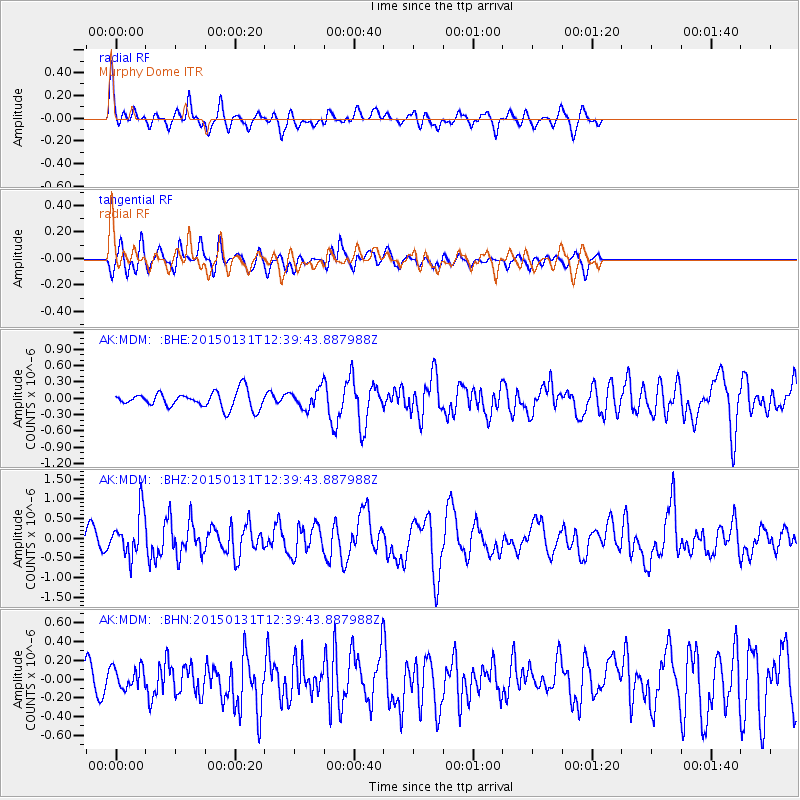
MDM Murphy Dome - Earthquake Result Viewer
*The percent match for this event was below the threshold and hence no stack was calculated.
| Earthquake location: |
Mariana Islands Region |
| Earthquake latitude/longitude: |
15.3/147.1 |
| Earthquake time(UTC): |
2015/01/31 (031) 12:29:31 GMT |
| Earthquake Depth: |
10 km |
| Earthquake Magnitude: |
5.7 MO |
| Earthquake Catalog/Contributor: |
NEIC PDE/NEIC ALERT |
|
| Network: |
AK Alaska Regional Network |
| Station: |
MDM Murphy Dome |
| Lat/Lon: |
64.96 N/148.23 W |
| Elevation: |
634 m |
|
| Distance: |
65.6 deg |
| Az: |
24.981 deg |
| Baz: |
253.263 deg |
| Ray Param: |
$rayparam |
*The percent match for this event was below the threshold and hence was not used in the summary stack. |
|
| Radial Match: |
76.36598 % |
| Radial Bump: |
400 |
| Transverse Match: |
66.81187 % |
| Transverse Bump: |
400 |
| SOD ConfigId: |
3390531 |
| Insert Time: |
2019-04-16 06:05:30.115 +0000 |
| GWidth: |
2.5 |
| Max Bumps: |
400 |
| Tol: |
0.001 |
|
Signal To Noise
| Channel | StoN | STA | LTA |
| AK:MDM: :BHZ:20150131T12:39:43.887988Z | 2.0089965 | 5.465063E-7 | 2.7202952E-7 |
| AK:MDM: :BHN:20150131T12:39:43.887988Z | 0.77841824 | 1.1339781E-7 | 1.4567722E-7 |
| AK:MDM: :BHE:20150131T12:39:43.887988Z | 1.3844805 | 2.0780641E-7 | 1.5009704E-7 |
| Arrivals |
| Ps | |
| PpPs | |
| PsPs/PpSs | |


