You are here: Home > Network List > TA - USArray Transportable Network (new EarthScope stations) Stations List
> Station L46A Eue Claire, MI, USA > Earthquake Result Viewer
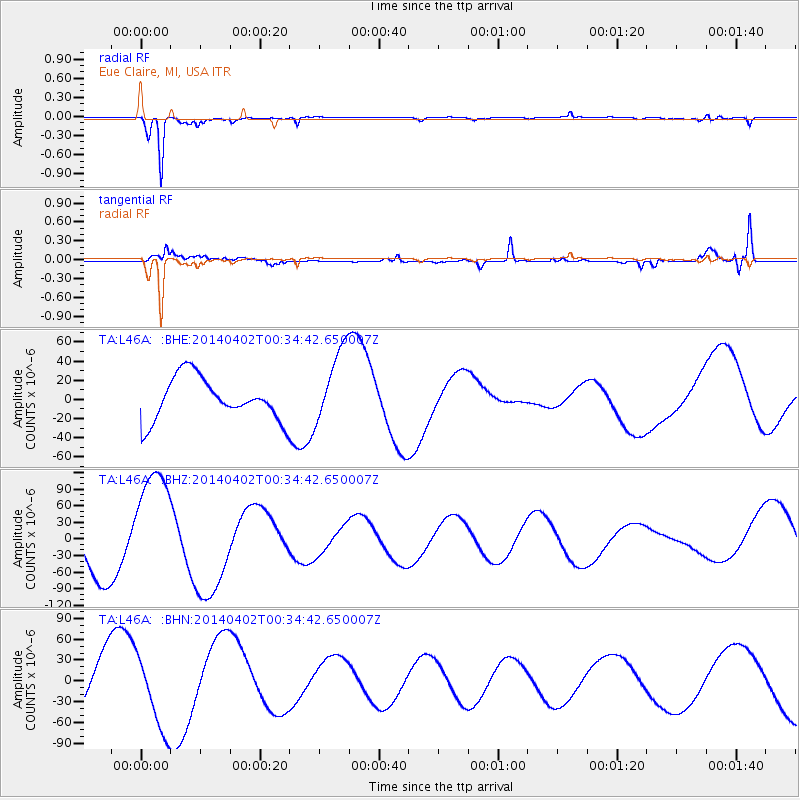
L46A Eue Claire, MI, USA - Earthquake Result Viewer
*The percent match for this event was below the threshold and hence no stack was calculated.
| Earthquake location: |
Near Coast Of Northern Chile |
| Earthquake latitude/longitude: |
-19.9/-70.7 |
| Earthquake time(UTC): |
2014/04/02 (092) 00:24:45 GMT |
| Earthquake Depth: |
10 km |
| Earthquake Magnitude: |
5.6 MB |
| Earthquake Catalog/Contributor: |
NEIC PDE/NEIC COMCAT |
|
| Network: |
TA USArray Transportable Network (new EarthScope stations) |
| Station: |
L46A Eue Claire, MI, USA |
| Lat/Lon: |
42.01 N/86.30 W |
| Elevation: |
223 m |
|
| Distance: |
63.3 deg |
| Az: |
347.058 deg |
| Baz: |
163.573 deg |
| Ray Param: |
$rayparam |
*The percent match for this event was below the threshold and hence was not used in the summary stack. |
|
| Radial Match: |
88.84528 % |
| Radial Bump: |
259 |
| Transverse Match: |
75.55356 % |
| Transverse Bump: |
400 |
| SOD ConfigId: |
626651 |
| Insert Time: |
2014-04-21 23:51:20.771 +0000 |
| GWidth: |
2.5 |
| Max Bumps: |
400 |
| Tol: |
0.001 |
|
Signal To Noise
| Channel | StoN | STA | LTA |
| TA:L46A: :BHZ:20140402T00:34:42.650007Z | 2.6135025 | 1.06531945E-4 | 4.0762134E-5 |
| TA:L46A: :BHN:20140402T00:34:42.650007Z | 2.363041 | 5.3966545E-5 | 2.2837754E-5 |
| TA:L46A: :BHE:20140402T00:34:42.650007Z | 1.8125571 | 3.9967636E-5 | 2.2050415E-5 |
| Arrivals |
| Ps | |
| PpPs | |
| PsPs/PpSs | |


