You are here: Home > Network List > CI - Caltech Regional Seismic Network Stations List
> Station MPP McPhearson Peak > Earthquake Result Viewer
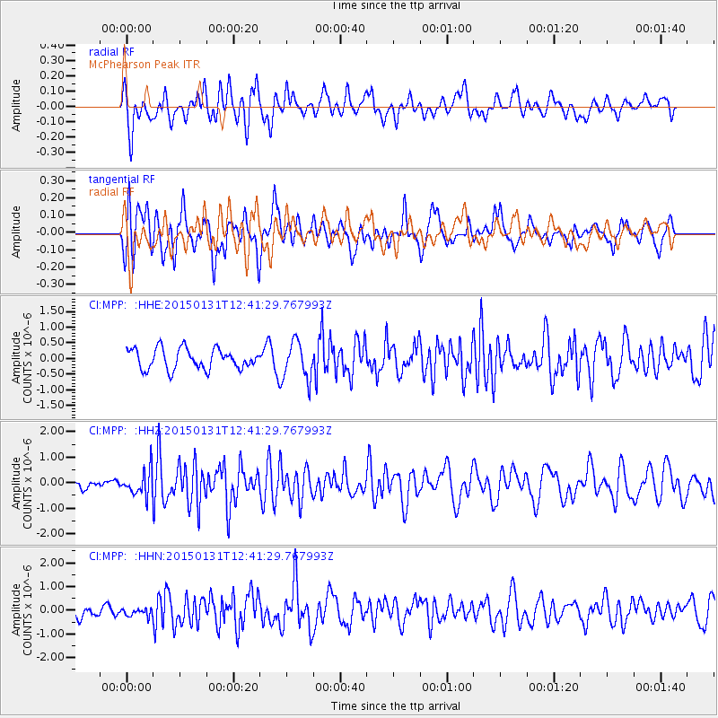
MPP McPhearson Peak - Earthquake Result Viewer
*The percent match for this event was below the threshold and hence no stack was calculated.
| Earthquake location: |
Mariana Islands Region |
| Earthquake latitude/longitude: |
15.3/147.1 |
| Earthquake time(UTC): |
2015/01/31 (031) 12:29:31 GMT |
| Earthquake Depth: |
10 km |
| Earthquake Magnitude: |
5.7 MO |
| Earthquake Catalog/Contributor: |
NEIC PDE/NEIC ALERT |
|
| Network: |
CI Caltech Regional Seismic Network |
| Station: |
MPP McPhearson Peak |
| Lat/Lon: |
34.89 N/119.81 W |
| Elevation: |
1739 m |
|
| Distance: |
83.9 deg |
| Az: |
55.647 deg |
| Baz: |
284.252 deg |
| Ray Param: |
$rayparam |
*The percent match for this event was below the threshold and hence was not used in the summary stack. |
|
| Radial Match: |
71.101 % |
| Radial Bump: |
400 |
| Transverse Match: |
68.01889 % |
| Transverse Bump: |
400 |
| SOD ConfigId: |
3390531 |
| Insert Time: |
2019-04-16 06:07:25.569 +0000 |
| GWidth: |
2.5 |
| Max Bumps: |
400 |
| Tol: |
0.001 |
|
Signal To Noise
| Channel | StoN | STA | LTA |
| CI:MPP: :HHZ:20150131T12:41:29.767993Z | 1.1497271 | 4.942461E-7 | 4.298812E-7 |
| CI:MPP: :HHN:20150131T12:41:29.767993Z | 0.70195216 | 1.7207253E-7 | 2.451343E-7 |
| CI:MPP: :HHE:20150131T12:41:29.767993Z | 1.7854393 | 5.7412797E-7 | 3.215612E-7 |
| Arrivals |
| Ps | |
| PpPs | |
| PsPs/PpSs | |


