You are here: Home > Network List > UW - Pacific Northwest Regional Seismic Network Stations List
> Station MRBL Marblemount, WA, USA > Earthquake Result Viewer
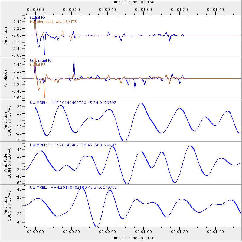
MRBL Marblemount, WA, USA - Earthquake Result Viewer
*The percent match for this event was below the threshold and hence no stack was calculated.
| Earthquake location: |
Near Coast Of Northern Chile |
| Earthquake latitude/longitude: |
-20.2/-70.7 |
| Earthquake time(UTC): |
2014/04/02 (092) 00:33:45 GMT |
| Earthquake Depth: |
13 km |
| Earthquake Magnitude: |
5.5 MB |
| Earthquake Catalog/Contributor: |
NEIC PDE/NEIC COMCAT |
|
| Network: |
UW Pacific Northwest Regional Seismic Network |
| Station: |
MRBL Marblemount, WA, USA |
| Lat/Lon: |
48.52 N/121.48 W |
| Elevation: |
75 m |
|
| Distance: |
82.1 deg |
| Az: |
328.657 deg |
| Baz: |
132.728 deg |
| Ray Param: |
$rayparam |
*The percent match for this event was below the threshold and hence was not used in the summary stack. |
|
| Radial Match: |
64.91482 % |
| Radial Bump: |
352 |
| Transverse Match: |
69.69941 % |
| Transverse Bump: |
318 |
| SOD ConfigId: |
626651 |
| Insert Time: |
2014-04-22 00:49:13.671 +0000 |
| GWidth: |
2.5 |
| Max Bumps: |
400 |
| Tol: |
0.001 |
|
Signal To Noise
| Channel | StoN | STA | LTA |
| UW:MRBL: :HHZ:20140402T00:45:34.017979Z | 2.0199447 | 3.540276E-5 | 1.7526598E-5 |
| UW:MRBL: :HHN:20140402T00:45:34.017979Z | 2.2644427 | 1.8685036E-5 | 8.251494E-6 |
| UW:MRBL: :HHE:20140402T00:45:34.017979Z | 0.31921834 | 4.889774E-6 | 1.531796E-5 |
| Arrivals |
| Ps | |
| PpPs | |
| PsPs/PpSs | |


