You are here: Home > Network List > TA - USArray Transportable Network (new EarthScope stations) Stations List
> Station G59A Clarenceville, QC, USA > Earthquake Result Viewer
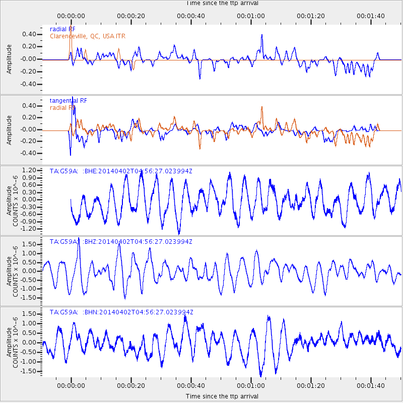
G59A Clarenceville, QC, USA - Earthquake Result Viewer
*The percent match for this event was below the threshold and hence no stack was calculated.
| Earthquake location: |
Near Coast Of Northern Chile |
| Earthquake latitude/longitude: |
-20.2/-70.9 |
| Earthquake time(UTC): |
2014/04/02 (092) 04:46:18 GMT |
| Earthquake Depth: |
10 km |
| Earthquake Magnitude: |
5.8 MB |
| Earthquake Catalog/Contributor: |
NEIC PDE/NEIC COMCAT |
|
| Network: |
TA USArray Transportable Network (new EarthScope stations) |
| Station: |
G59A Clarenceville, QC, USA |
| Lat/Lon: |
45.08 N/73.18 W |
| Elevation: |
36 m |
|
| Distance: |
65.0 deg |
| Az: |
358.178 deg |
| Baz: |
177.584 deg |
| Ray Param: |
$rayparam |
*The percent match for this event was below the threshold and hence was not used in the summary stack. |
|
| Radial Match: |
50.08226 % |
| Radial Bump: |
400 |
| Transverse Match: |
75.93593 % |
| Transverse Bump: |
400 |
| SOD ConfigId: |
626651 |
| Insert Time: |
2014-04-22 01:18:38.978 +0000 |
| GWidth: |
2.5 |
| Max Bumps: |
400 |
| Tol: |
0.001 |
|
Signal To Noise
| Channel | StoN | STA | LTA |
| TA:G59A: :BHZ:20140402T04:56:27.023994Z | 2.1513977 | 1.0364882E-6 | 4.8177435E-7 |
| TA:G59A: :BHN:20140402T04:56:27.023994Z | 0.573698 | 5.058887E-7 | 8.8180315E-7 |
| TA:G59A: :BHE:20140402T04:56:27.023994Z | 1.1273743 | 6.302324E-7 | 5.5902683E-7 |
| Arrivals |
| Ps | |
| PpPs | |
| PsPs/PpSs | |


