You are here: Home > Network List > TA - USArray Transportable Network (new EarthScope stations) Stations List
> Station R56A Bull Pasture Mountain, McDowell, VA, USA > Earthquake Result Viewer
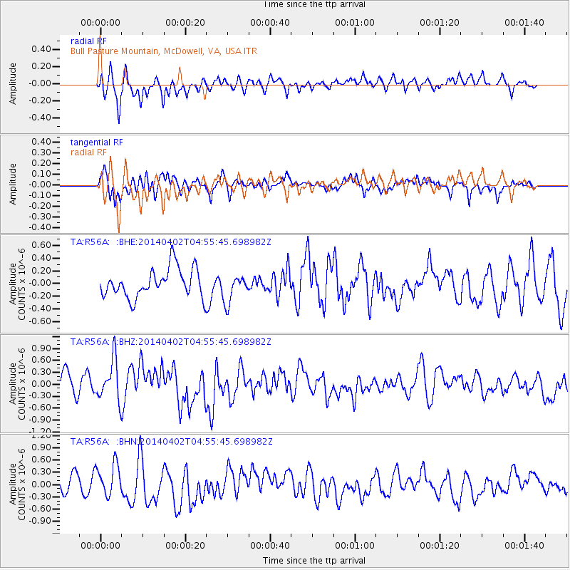
R56A Bull Pasture Mountain, McDowell, VA, USA - Earthquake Result Viewer
*The percent match for this event was below the threshold and hence no stack was calculated.
| Earthquake location: |
Near Coast Of Northern Chile |
| Earthquake latitude/longitude: |
-20.2/-70.9 |
| Earthquake time(UTC): |
2014/04/02 (092) 04:46:18 GMT |
| Earthquake Depth: |
10 km |
| Earthquake Magnitude: |
5.8 MB |
| Earthquake Catalog/Contributor: |
NEIC PDE/NEIC COMCAT |
|
| Network: |
TA USArray Transportable Network (new EarthScope stations) |
| Station: |
R56A Bull Pasture Mountain, McDowell, VA, USA |
| Lat/Lon: |
38.41 N/79.40 W |
| Elevation: |
902 m |
|
| Distance: |
58.8 deg |
| Az: |
352.15 deg |
| Baz: |
170.6 deg |
| Ray Param: |
$rayparam |
*The percent match for this event was below the threshold and hence was not used in the summary stack. |
|
| Radial Match: |
64.30095 % |
| Radial Bump: |
400 |
| Transverse Match: |
62.429737 % |
| Transverse Bump: |
400 |
| SOD ConfigId: |
626651 |
| Insert Time: |
2014-04-22 01:27:35.984 +0000 |
| GWidth: |
2.5 |
| Max Bumps: |
400 |
| Tol: |
0.001 |
|
Signal To Noise
| Channel | StoN | STA | LTA |
| TA:R56A: :BHZ:20140402T04:55:45.698982Z | 1.8472402 | 5.368064E-7 | 2.9059913E-7 |
| TA:R56A: :BHN:20140402T04:55:45.698982Z | 1.4223415 | 4.2629335E-7 | 2.9971238E-7 |
| TA:R56A: :BHE:20140402T04:55:45.698982Z | 0.99355793 | 2.2582105E-7 | 2.2728524E-7 |
| Arrivals |
| Ps | |
| PpPs | |
| PsPs/PpSs | |


