You are here: Home > Network List > TA - USArray Transportable Network (new EarthScope stations) Stations List
> Station U59A Littleton, NC, USA > Earthquake Result Viewer
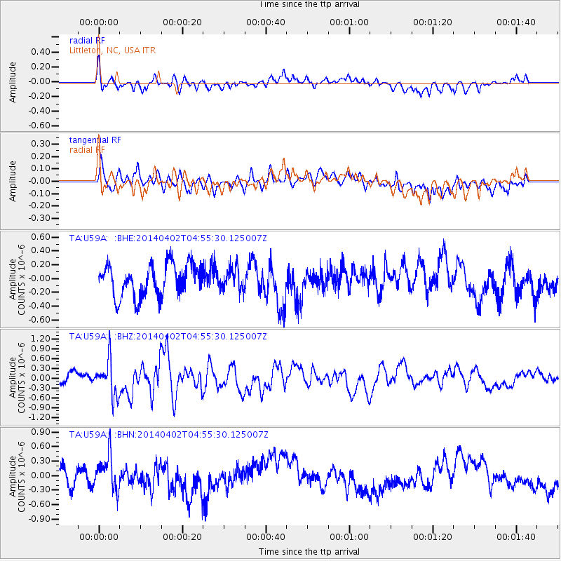
U59A Littleton, NC, USA - Earthquake Result Viewer
*The percent match for this event was below the threshold and hence no stack was calculated.
| Earthquake location: |
Near Coast Of Northern Chile |
| Earthquake latitude/longitude: |
-20.2/-70.9 |
| Earthquake time(UTC): |
2014/04/02 (092) 04:46:18 GMT |
| Earthquake Depth: |
10 km |
| Earthquake Magnitude: |
5.8 MB |
| Earthquake Catalog/Contributor: |
NEIC PDE/NEIC COMCAT |
|
| Network: |
TA USArray Transportable Network (new EarthScope stations) |
| Station: |
U59A Littleton, NC, USA |
| Lat/Lon: |
36.35 N/77.79 W |
| Elevation: |
99 m |
|
| Distance: |
56.6 deg |
| Az: |
353.288 deg |
| Baz: |
172.182 deg |
| Ray Param: |
$rayparam |
*The percent match for this event was below the threshold and hence was not used in the summary stack. |
|
| Radial Match: |
40.80458 % |
| Radial Bump: |
400 |
| Transverse Match: |
48.488117 % |
| Transverse Bump: |
400 |
| SOD ConfigId: |
626651 |
| Insert Time: |
2014-04-22 01:29:33.372 +0000 |
| GWidth: |
2.5 |
| Max Bumps: |
400 |
| Tol: |
0.001 |
|
Signal To Noise
| Channel | StoN | STA | LTA |
| TA:U59A: :BHZ:20140402T04:55:30.125007Z | 4.3392878 | 5.648598E-7 | 1.301734E-7 |
| TA:U59A: :BHN:20140402T04:55:30.125007Z | 1.7192038 | 3.6497883E-7 | 2.1229528E-7 |
| TA:U59A: :BHE:20140402T04:55:30.125007Z | 0.6937261 | 1.6062978E-7 | 2.315464E-7 |
| Arrivals |
| Ps | |
| PpPs | |
| PsPs/PpSs | |


