You are here: Home > Network List > TA - USArray Transportable Network (new EarthScope stations) Stations List
> Station Q53A Leroy, WV, USA > Earthquake Result Viewer
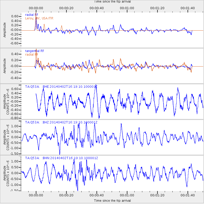
Q53A Leroy, WV, USA - Earthquake Result Viewer
*The percent match for this event was below the threshold and hence no stack was calculated.
| Earthquake location: |
South Of Panama |
| Earthquake latitude/longitude: |
7.9/-82.3 |
| Earthquake time(UTC): |
2014/04/02 (092) 16:13:27 GMT |
| Earthquake Depth: |
32 km |
| Earthquake Magnitude: |
6.0 MWW, 5.9 MWB, 6.0 MWC |
| Earthquake Catalog/Contributor: |
NEIC PDE/NEIC COMCAT |
|
| Network: |
TA USArray Transportable Network (new EarthScope stations) |
| Station: |
Q53A Leroy, WV, USA |
| Lat/Lon: |
38.86 N/81.53 W |
| Elevation: |
310 m |
|
| Distance: |
30.8 deg |
| Az: |
1.249 deg |
| Baz: |
181.585 deg |
| Ray Param: |
$rayparam |
*The percent match for this event was below the threshold and hence was not used in the summary stack. |
|
| Radial Match: |
62.684143 % |
| Radial Bump: |
400 |
| Transverse Match: |
49.686855 % |
| Transverse Bump: |
400 |
| SOD ConfigId: |
626651 |
| Insert Time: |
2014-04-22 02:13:55.695 +0000 |
| GWidth: |
2.5 |
| Max Bumps: |
400 |
| Tol: |
0.001 |
|
Signal To Noise
| Channel | StoN | STA | LTA |
| TA:Q53A: :BHZ:20140402T16:19:10.100001Z | 1.4036711 | 4.1148093E-7 | 2.9314623E-7 |
| TA:Q53A: :BHN:20140402T16:19:10.100001Z | 2.2725093 | 5.11298E-7 | 2.2499272E-7 |
| TA:Q53A: :BHE:20140402T16:19:10.100001Z | 0.6974068 | 2.04107E-7 | 2.9266562E-7 |
| Arrivals |
| Ps | |
| PpPs | |
| PsPs/PpSs | |


