You are here: Home > Network List > US - United States National Seismic Network Stations List
> Station DGMT Dagmar, Montana, USA > Earthquake Result Viewer
DGMT Dagmar, Montana, USA - Earthquake Result Viewer
*The percent match for this event was below the threshold and hence no stack was calculated.
| Earthquake location: |
South Of Panama |
| Earthquake latitude/longitude: |
7.9/-82.3 |
| Earthquake time(UTC): |
2014/04/02 (092) 16:13:27 GMT |
| Earthquake Depth: |
32 km |
| Earthquake Magnitude: |
6.0 MWW, 5.9 MWB, 6.0 MWC |
| Earthquake Catalog/Contributor: |
NEIC PDE/NEIC COMCAT |
|
| Network: |
US United States National Seismic Network |
| Station: |
DGMT Dagmar, Montana, USA |
| Lat/Lon: |
48.47 N/104.20 W |
| Elevation: |
0.0 m |
|
| Distance: |
44.4 deg |
| Az: |
339.286 deg |
| Baz: |
148.231 deg |
| Ray Param: |
$rayparam |
*The percent match for this event was below the threshold and hence was not used in the summary stack. |
|
| Radial Match: |
38.860123 % |
| Radial Bump: |
316 |
| Transverse Match: |
42.650665 % |
| Transverse Bump: |
362 |
| SOD ConfigId: |
626651 |
| Insert Time: |
2014-04-22 02:15:49.599 +0000 |
| GWidth: |
2.5 |
| Max Bumps: |
400 |
| Tol: |
0.001 |
|
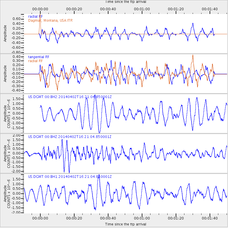
Signal To Noise
| Channel | StoN | STA | LTA |
| US:DGMT:00:BHZ:20140402T16:21:04.850001Z | 1.6612738 | 3.966983E-7 | 2.3879164E-7 |
| US:DGMT:00:BH1:20140402T16:21:04.850001Z | 1.1733007 | 7.0738537E-7 | 6.0290205E-7 |
| US:DGMT:00:BH2:20140402T16:21:04.850001Z | 2.4358425 | 1.2950474E-6 | 5.31663E-7 |
| Arrivals |
| Ps | |
| PpPs | |
| PsPs/PpSs | |


