You are here: Home > Network List > TA - USArray Transportable Network (new EarthScope stations) Stations List
> Station G59A Clarenceville, QC, USA > Earthquake Result Viewer
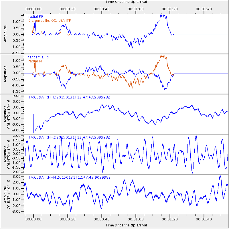
G59A Clarenceville, QC, USA - Earthquake Result Viewer
*The percent match for this event was below the threshold and hence no stack was calculated.
| Earthquake location: |
Pribilof Islands, Alaska Region |
| Earthquake latitude/longitude: |
56.6/-168.9 |
| Earthquake time(UTC): |
2015/01/31 (031) 12:38:31 GMT |
| Earthquake Depth: |
8.6 km |
| Earthquake Magnitude: |
5.3 MW, 5.2 mb, 5.1 MS |
| Earthquake Catalog/Contributor: |
ISC/ISC |
|
| Network: |
TA USArray Transportable Network (new EarthScope stations) |
| Station: |
G59A Clarenceville, QC, USA |
| Lat/Lon: |
45.08 N/73.18 W |
| Elevation: |
36 m |
|
| Distance: |
56.7 deg |
| Az: |
57.494 deg |
| Baz: |
318.863 deg |
| Ray Param: |
$rayparam |
*The percent match for this event was below the threshold and hence was not used in the summary stack. |
|
| Radial Match: |
24.802567 % |
| Radial Bump: |
400 |
| Transverse Match: |
12.5190735 % |
| Transverse Bump: |
400 |
| SOD ConfigId: |
3390531 |
| Insert Time: |
2019-04-16 06:29:50.866 +0000 |
| GWidth: |
2.5 |
| Max Bumps: |
400 |
| Tol: |
0.001 |
|
Signal To Noise
| Channel | StoN | STA | LTA |
| TA:G59A: :HHZ:20150131T12:47:43.909998Z | 0.6210769 | 5.7186065E-7 | 9.207565E-7 |
| TA:G59A: :HHN:20150131T12:47:43.909998Z | 0.9197672 | 8.722748E-7 | 9.483648E-7 |
| TA:G59A: :HHE:20150131T12:47:43.909998Z | 0.7989933 | 2.5667841E-6 | 3.2125226E-6 |
| Arrivals |
| Ps | |
| PpPs | |
| PsPs/PpSs | |


