You are here: Home > Network List > TA - USArray Transportable Network (new EarthScope stations) Stations List
> Station H46A Fife Lake, MI, USA > Earthquake Result Viewer
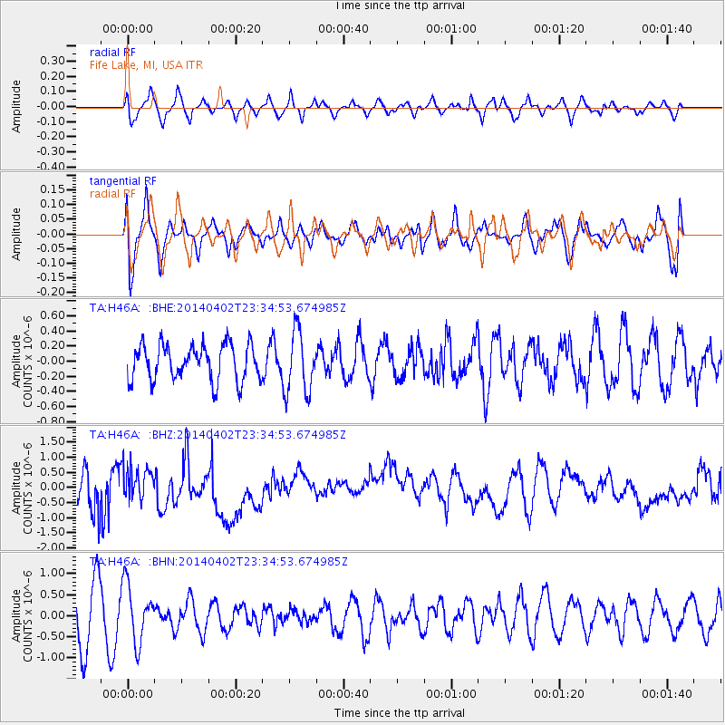
H46A Fife Lake, MI, USA - Earthquake Result Viewer
*The percent match for this event was below the threshold and hence no stack was calculated.
| Earthquake location: |
Eastern Honshu, Japan |
| Earthquake latitude/longitude: |
39.2/141.8 |
| Earthquake time(UTC): |
2014/04/02 (092) 23:22:47 GMT |
| Earthquake Depth: |
56 km |
| Earthquake Magnitude: |
5.6 MB, 5.5 MWC |
| Earthquake Catalog/Contributor: |
NEIC PDE/NEIC COMCAT |
|
| Network: |
TA USArray Transportable Network (new EarthScope stations) |
| Station: |
H46A Fife Lake, MI, USA |
| Lat/Lon: |
44.54 N/85.20 W |
| Elevation: |
329 m |
|
| Distance: |
86.5 deg |
| Az: |
31.581 deg |
| Baz: |
325.314 deg |
| Ray Param: |
$rayparam |
*The percent match for this event was below the threshold and hence was not used in the summary stack. |
|
| Radial Match: |
43.652813 % |
| Radial Bump: |
400 |
| Transverse Match: |
49.169525 % |
| Transverse Bump: |
400 |
| SOD ConfigId: |
626651 |
| Insert Time: |
2014-04-22 02:57:56.148 +0000 |
| GWidth: |
2.5 |
| Max Bumps: |
400 |
| Tol: |
0.001 |
|
Signal To Noise
| Channel | StoN | STA | LTA |
| TA:H46A: :BHZ:20140402T23:34:53.674985Z | 0.48691222 | 4.7523542E-7 | 9.760187E-7 |
| TA:H46A: :BHN:20140402T23:34:53.674985Z | 1.1057364 | 6.847325E-7 | 6.192548E-7 |
| TA:H46A: :BHE:20140402T23:34:53.674985Z | 1.7543803 | 4.1305222E-7 | 2.3544052E-7 |
| Arrivals |
| Ps | |
| PpPs | |
| PsPs/PpSs | |


