You are here: Home > Network List > TA - USArray Transportable Network (new EarthScope stations) Stations List
> Station N23A Red Feather Lakes, CO, USA > Earthquake Result Viewer
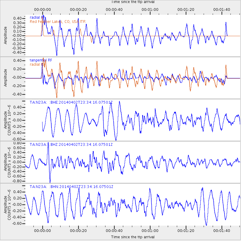
N23A Red Feather Lakes, CO, USA - Earthquake Result Viewer
*The percent match for this event was below the threshold and hence no stack was calculated.
| Earthquake location: |
Eastern Honshu, Japan |
| Earthquake latitude/longitude: |
39.2/141.8 |
| Earthquake time(UTC): |
2014/04/02 (092) 23:22:47 GMT |
| Earthquake Depth: |
56 km |
| Earthquake Magnitude: |
5.6 MB, 5.5 MWC |
| Earthquake Catalog/Contributor: |
NEIC PDE/NEIC COMCAT |
|
| Network: |
TA USArray Transportable Network (new EarthScope stations) |
| Station: |
N23A Red Feather Lakes, CO, USA |
| Lat/Lon: |
40.89 N/105.94 W |
| Elevation: |
2458 m |
|
| Distance: |
79.2 deg |
| Az: |
45.564 deg |
| Baz: |
312.953 deg |
| Ray Param: |
$rayparam |
*The percent match for this event was below the threshold and hence was not used in the summary stack. |
|
| Radial Match: |
61.237976 % |
| Radial Bump: |
400 |
| Transverse Match: |
55.514923 % |
| Transverse Bump: |
400 |
| SOD ConfigId: |
626651 |
| Insert Time: |
2014-04-22 03:01:58.087 +0000 |
| GWidth: |
2.5 |
| Max Bumps: |
400 |
| Tol: |
0.001 |
|
Signal To Noise
| Channel | StoN | STA | LTA |
| TA:N23A: :BHZ:20140402T23:34:16.07501Z | 1.4954971 | 3.744542E-7 | 2.5038779E-7 |
| TA:N23A: :BHN:20140402T23:34:16.07501Z | 1.4178219 | 3.069715E-7 | 2.165092E-7 |
| TA:N23A: :BHE:20140402T23:34:16.07501Z | 0.8548649 | 2.4358835E-7 | 2.8494367E-7 |
| Arrivals |
| Ps | |
| PpPs | |
| PsPs/PpSs | |


