You are here: Home > Network List > TA - USArray Transportable Network (new EarthScope stations) Stations List
> Station N56A West Decatur, PA, USA > Earthquake Result Viewer
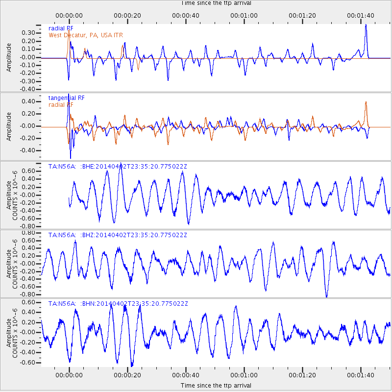
N56A West Decatur, PA, USA - Earthquake Result Viewer
*The percent match for this event was below the threshold and hence no stack was calculated.
| Earthquake location: |
Eastern Honshu, Japan |
| Earthquake latitude/longitude: |
39.2/141.8 |
| Earthquake time(UTC): |
2014/04/02 (092) 23:22:47 GMT |
| Earthquake Depth: |
56 km |
| Earthquake Magnitude: |
5.6 MB, 5.5 MWC |
| Earthquake Catalog/Contributor: |
NEIC PDE/NEIC COMCAT |
|
| Network: |
TA USArray Transportable Network (new EarthScope stations) |
| Station: |
N56A West Decatur, PA, USA |
| Lat/Lon: |
40.92 N/78.30 W |
| Elevation: |
561 m |
|
| Distance: |
92.3 deg |
| Az: |
29.218 deg |
| Baz: |
329.965 deg |
| Ray Param: |
$rayparam |
*The percent match for this event was below the threshold and hence was not used in the summary stack. |
|
| Radial Match: |
48.216835 % |
| Radial Bump: |
400 |
| Transverse Match: |
68.00346 % |
| Transverse Bump: |
400 |
| SOD ConfigId: |
626651 |
| Insert Time: |
2014-04-22 03:02:27.455 +0000 |
| GWidth: |
2.5 |
| Max Bumps: |
400 |
| Tol: |
0.001 |
|
Signal To Noise
| Channel | StoN | STA | LTA |
| TA:N56A: :BHZ:20140402T23:35:20.775022Z | 1.0846833 | 2.9832515E-7 | 2.7503432E-7 |
| TA:N56A: :BHN:20140402T23:35:20.775022Z | 1.6895614 | 3.4423977E-7 | 2.0374506E-7 |
| TA:N56A: :BHE:20140402T23:35:20.775022Z | 0.7937155 | 2.6542492E-7 | 3.3440816E-7 |
| Arrivals |
| Ps | |
| PpPs | |
| PsPs/PpSs | |


