You are here: Home > Network List > US - United States National Seismic Network Stations List
> Station DGMT Dagmar, Montana, USA > Earthquake Result Viewer
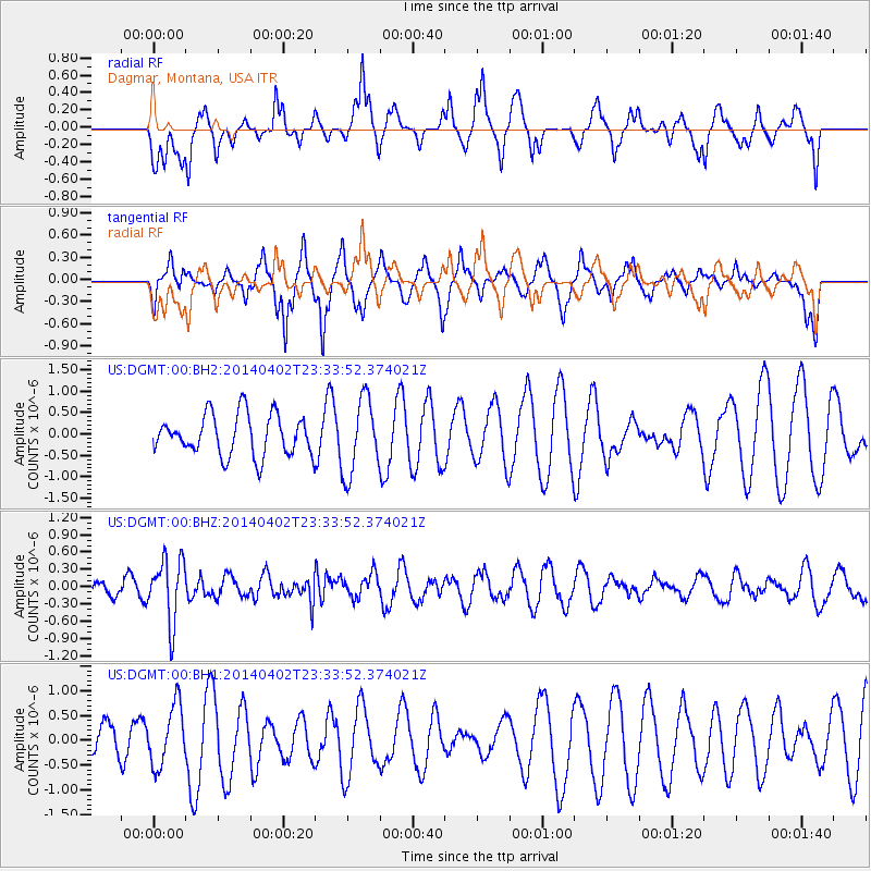
DGMT Dagmar, Montana, USA - Earthquake Result Viewer
*The percent match for this event was below the threshold and hence no stack was calculated.
| Earthquake location: |
Eastern Honshu, Japan |
| Earthquake latitude/longitude: |
39.2/141.8 |
| Earthquake time(UTC): |
2014/04/02 (092) 23:22:47 GMT |
| Earthquake Depth: |
56 km |
| Earthquake Magnitude: |
5.6 MB, 5.5 MWC |
| Earthquake Catalog/Contributor: |
NEIC PDE/NEIC COMCAT |
|
| Network: |
US United States National Seismic Network |
| Station: |
DGMT Dagmar, Montana, USA |
| Lat/Lon: |
48.47 N/104.20 W |
| Elevation: |
0.0 m |
|
| Distance: |
75.0 deg |
| Az: |
38.997 deg |
| Baz: |
312.712 deg |
| Ray Param: |
$rayparam |
*The percent match for this event was below the threshold and hence was not used in the summary stack. |
|
| Radial Match: |
47.589233 % |
| Radial Bump: |
376 |
| Transverse Match: |
54.199272 % |
| Transverse Bump: |
343 |
| SOD ConfigId: |
626651 |
| Insert Time: |
2014-04-22 03:08:39.973 +0000 |
| GWidth: |
2.5 |
| Max Bumps: |
400 |
| Tol: |
0.001 |
|
Signal To Noise
| Channel | StoN | STA | LTA |
| US:DGMT:00:BHZ:20140402T23:33:52.374021Z | 5.2018914 | 5.479995E-7 | 1.05346196E-7 |
| US:DGMT:00:BH1:20140402T23:33:52.374021Z | 1.2738627 | 6.1227945E-7 | 4.806479E-7 |
| US:DGMT:00:BH2:20140402T23:33:52.374021Z | 1.8640877 | 8.872513E-7 | 4.7597078E-7 |
| Arrivals |
| Ps | |
| PpPs | |
| PsPs/PpSs | |


