TUPA Temple University, Pennsylvania - Earthquake Result Viewer
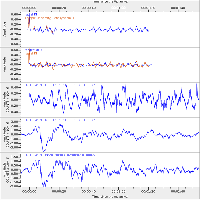
Earthquake location: Near Coast Of Northern Chile
Earthquake latitude/longitude: -20.3/-70.6
Earthquake time(UTC): 2014/04/03 (093) 01:58:31 GMT
Earthquake Depth: 23 km
Earthquake Magnitude: 6.5 MWW, 6.5 MWB, 6.6 MWC
Earthquake Catalog/Contributor: NEIC PDE/NEIC COMCAT
Network: LD Lamont-Doherty Cooperative Seismographic Network
Station: TUPA Temple University, Pennsylvania
Lat/Lon: 40.17 N/75.19 W
Elevation: 112 m
Distance: 60.3 deg
Az: 355.915 deg
Baz: 174.993 deg
Ray Param: 0.06161006
Estimated Moho Depth: 47.25 km
Estimated Crust Vp/Vs: 1.96
Assumed Crust Vp: 6.283 km/s
Estimated Crust Vs: 3.214 km/s
Estimated Crust Poisson's Ratio: 0.32
Radial Match: 92.042595 %
Radial Bump: 394
Transverse Match: 62.556873 %
Transverse Bump: 400
SOD ConfigId: 626651
Insert Time: 2014-04-22 03:34:09.225 +0000
GWidth: 2.5
Max Bumps: 400
Tol: 0.001

Signal To Noise

ChannelStoNSTALTA
LD:TUPA: :HHZ:20140403T02:08:07.010007Z8.556241.0225099E-61.1950458E-7
LD:TUPA: :HHN:20140403T02:08:07.010007Z3.78143225.895879E-71.5591657E-7
LD:TUPA: :HHE:20140403T02:08:07.010007Z1.02487831.6352422E-71.5955477E-7
Arrivals
Ps7.5 SECOND
PpPs21 SECOND
PsPs/PpSs29 SECOND