You are here: Home > Network List > TA - USArray Transportable Network (new EarthScope stations) Stations List
> Station A21K Barrow, AK, USA > Earthquake Result Viewer
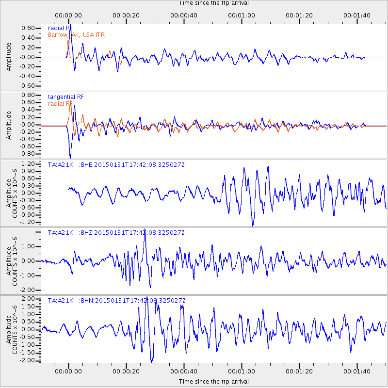
A21K Barrow, AK, USA - Earthquake Result Viewer
*The percent match for this event was below the threshold and hence no stack was calculated.
| Earthquake location: |
Banda Sea |
| Earthquake latitude/longitude: |
-6.9/127.5 |
| Earthquake time(UTC): |
2015/01/31 (031) 17:30:09 GMT |
| Earthquake Depth: |
343 km |
| Earthquake Magnitude: |
5.5 MW, 5.0 mb |
| Earthquake Catalog/Contributor: |
ISC/ISC |
|
| Network: |
TA USArray Transportable Network (new EarthScope stations) |
| Station: |
A21K Barrow, AK, USA |
| Lat/Lon: |
71.32 N/156.62 W |
| Elevation: |
577 m |
|
| Distance: |
92.0 deg |
| Az: |
18.217 deg |
| Baz: |
254.461 deg |
| Ray Param: |
$rayparam |
*The percent match for this event was below the threshold and hence was not used in the summary stack. |
|
| Radial Match: |
79.1917 % |
| Radial Bump: |
341 |
| Transverse Match: |
88.81083 % |
| Transverse Bump: |
352 |
| SOD ConfigId: |
3390531 |
| Insert Time: |
2019-04-16 06:57:52.961 +0000 |
| GWidth: |
2.5 |
| Max Bumps: |
400 |
| Tol: |
0.001 |
|
Signal To Noise
| Channel | StoN | STA | LTA |
| TA:A21K: :BHZ:20150131T17:42:08.325027Z | 3.2485101 | 3.5921306E-7 | 1.1057779E-7 |
| TA:A21K: :BHN:20150131T17:42:08.325027Z | 1.4080999 | 2.8190522E-7 | 2.0020256E-7 |
| TA:A21K: :BHE:20150131T17:42:08.325027Z | 0.9004627 | 1.6285044E-7 | 1.8085196E-7 |
| Arrivals |
| Ps | |
| PpPs | |
| PsPs/PpSs | |


