You are here: Home > Network List > GS - US Geological Survey Networks Stations List
> Station DEC06 Boomer > Earthquake Result Viewer
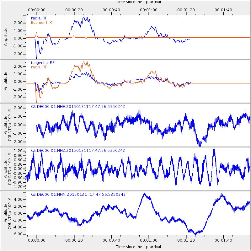
DEC06 Boomer - Earthquake Result Viewer
*The percent match for this event was below the threshold and hence no stack was calculated.
| Earthquake location: |
Pribilof Islands, Alaska Region |
| Earthquake latitude/longitude: |
56.7/-169.1 |
| Earthquake time(UTC): |
2015/01/31 (031) 17:39:12 GMT |
| Earthquake Depth: |
10 km |
| Earthquake Magnitude: |
5.4 MW, 5.3 mb, 5.0 MS |
| Earthquake Catalog/Contributor: |
ISC/ISC |
|
| Network: |
GS US Geological Survey Networks |
| Station: |
DEC06 Boomer |
| Lat/Lon: |
39.90 N/88.95 W |
| Elevation: |
215 m |
|
| Distance: |
52.8 deg |
| Az: |
72.205 deg |
| Baz: |
316.882 deg |
| Ray Param: |
$rayparam |
*The percent match for this event was below the threshold and hence was not used in the summary stack. |
|
| Radial Match: |
21.74933 % |
| Radial Bump: |
400 |
| Transverse Match: |
25.747707 % |
| Transverse Bump: |
400 |
| SOD ConfigId: |
6954951 |
| Insert Time: |
2019-04-16 07:09:06.891 +0000 |
| GWidth: |
2.5 |
| Max Bumps: |
400 |
| Tol: |
0.001 |
|
Signal To Noise
| Channel | StoN | STA | LTA |
| GS:DEC06:01:HHZ:20150131T17:47:56.535024Z | 1.1872796 | 4.7626554E-7 | 4.0114017E-7 |
| GS:DEC06:01:HHN:20150131T17:47:56.535024Z | 0.32302672 | 7.270677E-7 | 2.2507975E-6 |
| GS:DEC06:01:HHE:20150131T17:47:56.535024Z | 0.8866517 | 6.0856604E-7 | 6.863643E-7 |
| Arrivals |
| Ps | |
| PpPs | |
| PsPs/PpSs | |


