You are here: Home > Network List > TA - USArray Transportable Network (new EarthScope stations) Stations List
> Station S49A Springfield, KY, USA > Earthquake Result Viewer
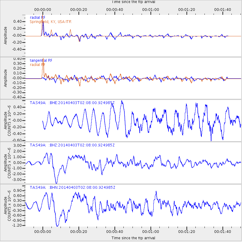
S49A Springfield, KY, USA - Earthquake Result Viewer
*The percent match for this event was below the threshold and hence no stack was calculated.
| Earthquake location: |
Near Coast Of Northern Chile |
| Earthquake latitude/longitude: |
-20.3/-70.6 |
| Earthquake time(UTC): |
2014/04/03 (093) 01:58:31 GMT |
| Earthquake Depth: |
23 km |
| Earthquake Magnitude: |
6.5 MWW, 6.5 MWB, 6.6 MWC |
| Earthquake Catalog/Contributor: |
NEIC PDE/NEIC COMCAT |
|
| Network: |
TA USArray Transportable Network (new EarthScope stations) |
| Station: |
S49A Springfield, KY, USA |
| Lat/Lon: |
37.78 N/85.29 W |
| Elevation: |
230 m |
|
| Distance: |
59.4 deg |
| Az: |
346.461 deg |
| Baz: |
163.894 deg |
| Ray Param: |
$rayparam |
*The percent match for this event was below the threshold and hence was not used in the summary stack. |
|
| Radial Match: |
74.80522 % |
| Radial Bump: |
336 |
| Transverse Match: |
43.438446 % |
| Transverse Bump: |
400 |
| SOD ConfigId: |
626651 |
| Insert Time: |
2014-04-22 04:03:34.268 +0000 |
| GWidth: |
2.5 |
| Max Bumps: |
400 |
| Tol: |
0.001 |
|
Signal To Noise
| Channel | StoN | STA | LTA |
| TA:S49A: :BHZ:20140403T02:08:00.924985Z | 4.924197 | 1.0919023E-6 | 2.2174218E-7 |
| TA:S49A: :BHN:20140403T02:08:00.924985Z | 2.1384084 | 4.7481538E-7 | 2.2204149E-7 |
| TA:S49A: :BHE:20140403T02:08:00.924985Z | 1.6715087 | 2.3885957E-7 | 1.4290059E-7 |
| Arrivals |
| Ps | |
| PpPs | |
| PsPs/PpSs | |


