You are here: Home > Network List > TA - USArray Transportable Network (new EarthScope stations) Stations List
> Station P59A Jarrettsville, MD, USA > Earthquake Result Viewer
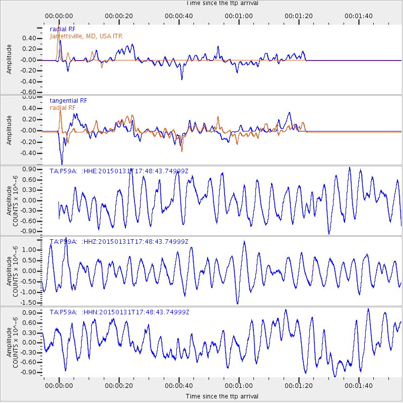
P59A Jarrettsville, MD, USA - Earthquake Result Viewer
*The percent match for this event was below the threshold and hence no stack was calculated.
| Earthquake location: |
Pribilof Islands, Alaska Region |
| Earthquake latitude/longitude: |
56.7/-169.1 |
| Earthquake time(UTC): |
2015/01/31 (031) 17:39:12 GMT |
| Earthquake Depth: |
10 km |
| Earthquake Magnitude: |
5.4 MW, 5.3 mb, 5.0 MS |
| Earthquake Catalog/Contributor: |
ISC/ISC |
|
| Network: |
TA USArray Transportable Network (new EarthScope stations) |
| Station: |
P59A Jarrettsville, MD, USA |
| Lat/Lon: |
39.61 N/76.43 W |
| Elevation: |
157 m |
|
| Distance: |
59.4 deg |
| Az: |
63.733 deg |
| Baz: |
320.128 deg |
| Ray Param: |
$rayparam |
*The percent match for this event was below the threshold and hence was not used in the summary stack. |
|
| Radial Match: |
45.209724 % |
| Radial Bump: |
400 |
| Transverse Match: |
29.502857 % |
| Transverse Bump: |
400 |
| SOD ConfigId: |
6954951 |
| Insert Time: |
2019-04-16 07:21:56.185 +0000 |
| GWidth: |
2.5 |
| Max Bumps: |
400 |
| Tol: |
0.001 |
|
Signal To Noise
| Channel | StoN | STA | LTA |
| TA:P59A: :HHZ:20150131T17:48:43.74999Z | 1.9160004 | 7.9587863E-7 | 4.1538544E-7 |
| TA:P59A: :HHN:20150131T17:48:43.74999Z | 0.6699679 | 4.148029E-7 | 6.1913846E-7 |
| TA:P59A: :HHE:20150131T17:48:43.74999Z | 1.0932872 | 4.1384394E-7 | 3.7853175E-7 |
| Arrivals |
| Ps | |
| PpPs | |
| PsPs/PpSs | |


