You are here: Home > Network List > TA - USArray Transportable Network (new EarthScope stations) Stations List
> Station R59A King George, VA, USA > Earthquake Result Viewer
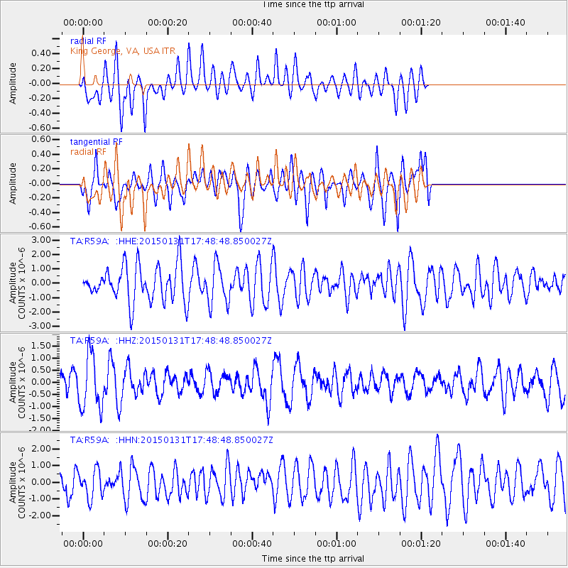
R59A King George, VA, USA - Earthquake Result Viewer
*The percent match for this event was below the threshold and hence no stack was calculated.
| Earthquake location: |
Pribilof Islands, Alaska Region |
| Earthquake latitude/longitude: |
56.7/-169.1 |
| Earthquake time(UTC): |
2015/01/31 (031) 17:39:12 GMT |
| Earthquake Depth: |
10 km |
| Earthquake Magnitude: |
5.4 MW, 5.3 mb, 5.0 MS |
| Earthquake Catalog/Contributor: |
ISC/ISC |
|
| Network: |
TA USArray Transportable Network (new EarthScope stations) |
| Station: |
R59A King George, VA, USA |
| Lat/Lon: |
38.20 N/77.12 W |
| Elevation: |
35 m |
|
| Distance: |
60.1 deg |
| Az: |
65.249 deg |
| Baz: |
320.465 deg |
| Ray Param: |
$rayparam |
*The percent match for this event was below the threshold and hence was not used in the summary stack. |
|
| Radial Match: |
47.335266 % |
| Radial Bump: |
400 |
| Transverse Match: |
48.179626 % |
| Transverse Bump: |
400 |
| SOD ConfigId: |
6954951 |
| Insert Time: |
2019-04-16 07:22:06.894 +0000 |
| GWidth: |
2.5 |
| Max Bumps: |
400 |
| Tol: |
0.001 |
|
Signal To Noise
| Channel | StoN | STA | LTA |
| TA:R59A: :HHZ:20150131T17:48:48.850027Z | 2.4789107 | 1.1440948E-6 | 4.6153124E-7 |
| TA:R59A: :HHN:20150131T17:48:48.850027Z | 1.016815 | 8.7062205E-7 | 8.562247E-7 |
| TA:R59A: :HHE:20150131T17:48:48.850027Z | 1.1285682 | 1.3742858E-6 | 1.2177252E-6 |
| Arrivals |
| Ps | |
| PpPs | |
| PsPs/PpSs | |


