You are here: Home > Network List > US - United States National Seismic Network Stations List
> Station AMTX Amarillo, Texas, USA > Earthquake Result Viewer
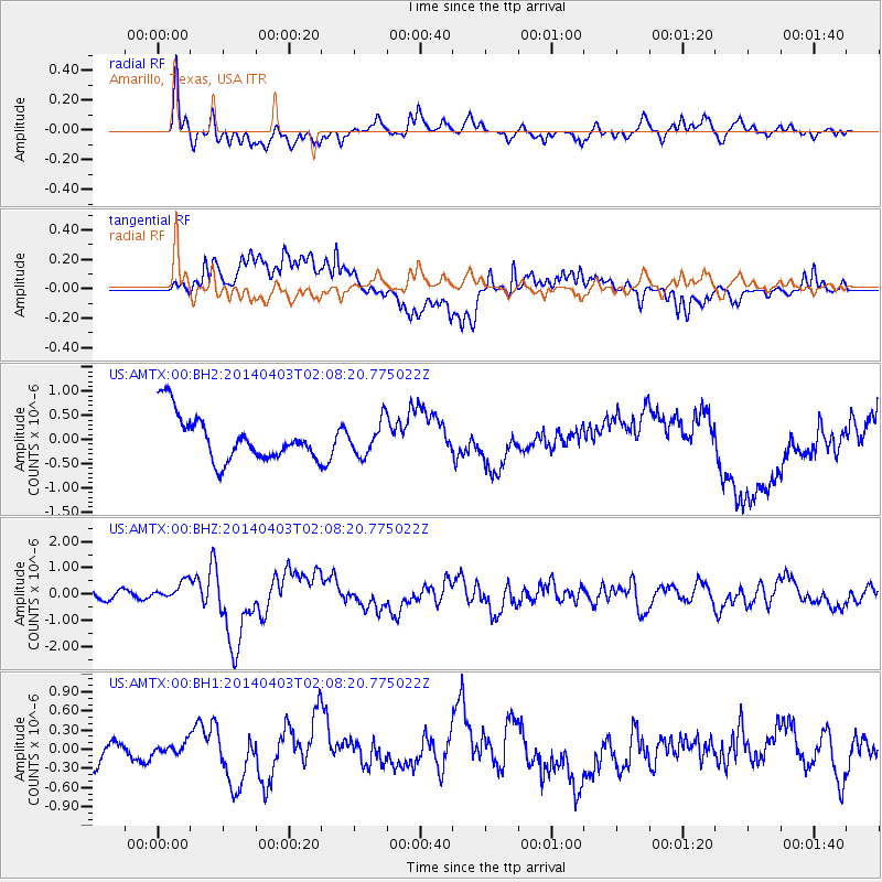
AMTX Amarillo, Texas, USA - Earthquake Result Viewer
*The percent match for this event was below the threshold and hence no stack was calculated.
| Earthquake location: |
Near Coast Of Northern Chile |
| Earthquake latitude/longitude: |
-20.3/-70.6 |
| Earthquake time(UTC): |
2014/04/03 (093) 01:58:31 GMT |
| Earthquake Depth: |
23 km |
| Earthquake Magnitude: |
6.5 MWW, 6.5 MWB, 6.6 MWC |
| Earthquake Catalog/Contributor: |
NEIC PDE/NEIC COMCAT |
|
| Network: |
US United States National Seismic Network |
| Station: |
AMTX Amarillo, Texas, USA |
| Lat/Lon: |
34.53 N/101.41 W |
| Elevation: |
1010 m |
|
| Distance: |
61.9 deg |
| Az: |
331.315 deg |
| Baz: |
146.919 deg |
| Ray Param: |
$rayparam |
*The percent match for this event was below the threshold and hence was not used in the summary stack. |
|
| Radial Match: |
73.30506 % |
| Radial Bump: |
400 |
| Transverse Match: |
70.02311 % |
| Transverse Bump: |
400 |
| SOD ConfigId: |
626651 |
| Insert Time: |
2014-04-22 04:08:28.677 +0000 |
| GWidth: |
2.5 |
| Max Bumps: |
400 |
| Tol: |
0.001 |
|
Signal To Noise
| Channel | StoN | STA | LTA |
| US:AMTX:00:BHZ:20140403T02:08:20.775022Z | 1.9926258 | 3.440644E-7 | 1.7266885E-7 |
| US:AMTX:00:BH1:20140403T02:08:20.775022Z | 0.27054232 | 8.0903376E-8 | 2.9904146E-7 |
| US:AMTX:00:BH2:20140403T02:08:20.775022Z | 0.6256713 | 3.008945E-7 | 4.8091465E-7 |
| Arrivals |
| Ps | |
| PpPs | |
| PsPs/PpSs | |


