You are here: Home > Network List > GS - US Geological Survey Networks Stations List
> Station KAN13 Rinehart Farm > Earthquake Result Viewer
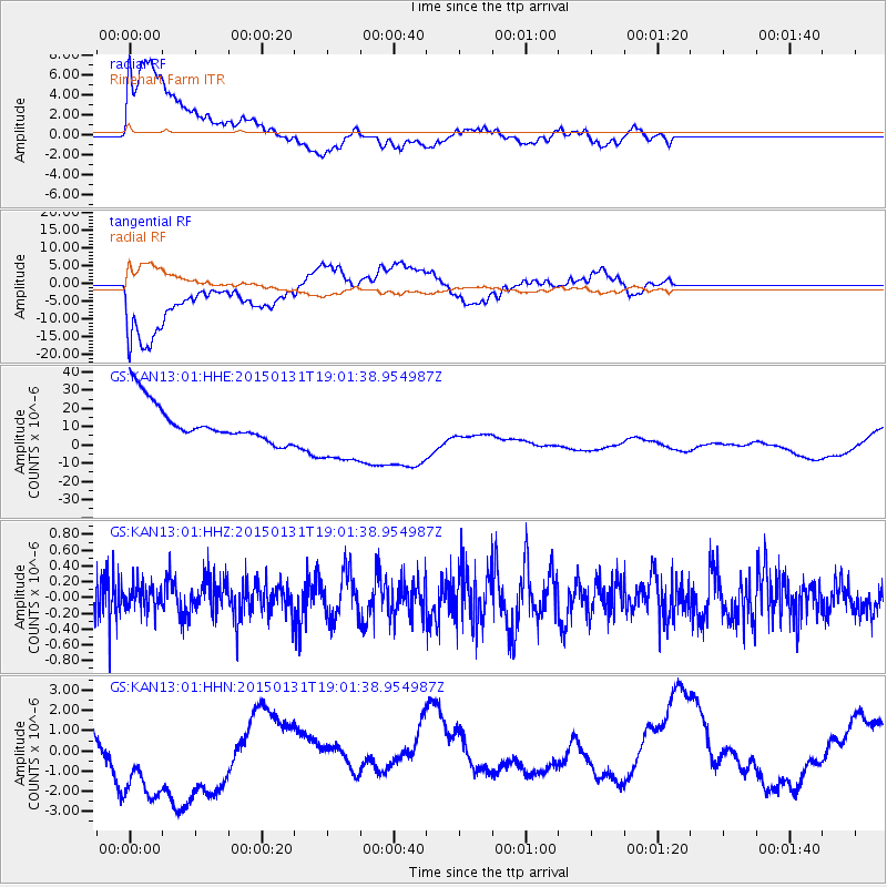
KAN13 Rinehart Farm - Earthquake Result Viewer
*The percent match for this event was below the threshold and hence no stack was calculated.
| Earthquake location: |
South Of Panama |
| Earthquake latitude/longitude: |
7.7/-82.9 |
| Earthquake time(UTC): |
2015/01/31 (031) 18:55:43 GMT |
| Earthquake Depth: |
9.1 km |
| Earthquake Magnitude: |
5.2 MW, 4.7 mb, 4.6 MS |
| Earthquake Catalog/Contributor: |
ISC/ISC |
|
| Network: |
GS US Geological Survey Networks |
| Station: |
KAN13 Rinehart Farm |
| Lat/Lon: |
37.01 N/97.48 W |
| Elevation: |
340 m |
|
| Distance: |
32.0 deg |
| Az: |
337.673 deg |
| Baz: |
151.943 deg |
| Ray Param: |
$rayparam |
*The percent match for this event was below the threshold and hence was not used in the summary stack. |
|
| Radial Match: |
45.165993 % |
| Radial Bump: |
400 |
| Transverse Match: |
44.245537 % |
| Transverse Bump: |
400 |
| SOD ConfigId: |
6954951 |
| Insert Time: |
2019-04-16 07:46:07.281 +0000 |
| GWidth: |
2.5 |
| Max Bumps: |
400 |
| Tol: |
0.001 |
|
Signal To Noise
| Channel | StoN | STA | LTA |
| GS:KAN13:01:HHZ:20150131T19:01:38.954987Z | 0.33191034 | 1.6891651E-7 | 5.0892214E-7 |
| GS:KAN13:01:HHN:20150131T19:01:38.954987Z | 2.5957947 | 3.6080958E-6 | 1.3899773E-6 |
| GS:KAN13:01:HHE:20150131T19:01:38.954987Z | 1.7794218 | 1.8691962E-5 | 1.0504515E-5 |
| Arrivals |
| Ps | |
| PpPs | |
| PsPs/PpSs | |


