You are here: Home > Network List > TA - USArray Transportable Network (new EarthScope stations) Stations List
> Station KMSC Kings Mountain, Blacksburg, SC, USA > Earthquake Result Viewer
KMSC Kings Mountain, Blacksburg, SC, USA - Earthquake Result Viewer

| Earthquake location: |
Near Coast Of Northern Chile |
| Earthquake latitude/longitude: |
-20.5/-70.5 |
| Earthquake time(UTC): |
2014/04/03 (093) 02:43:14 GMT |
| Earthquake Depth: |
31 km |
| Earthquake Magnitude: |
7.7 MWW, 7.4 MI, 7.7 MWC |
| Earthquake Catalog/Contributor: |
NEIC PDE/NEIC COMCAT |
|
| Network: |
TA USArray Transportable Network (new EarthScope stations) |
| Station: |
KMSC Kings Mountain, Blacksburg, SC, USA |
| Lat/Lon: |
35.14 N/81.33 W |
| Elevation: |
240 m |
|
| Distance: |
56.3 deg |
| Az: |
349.328 deg |
| Baz: |
167.772 deg |
| Ray Param: |
0.064177155 |
| Estimated Moho Depth: |
26.25 km |
| Estimated Crust Vp/Vs: |
2.08 |
| Assumed Crust Vp: |
6.419 km/s |
| Estimated Crust Vs: |
3.09 km/s |
| Estimated Crust Poisson's Ratio: |
0.35 |
|
| Radial Match: |
98.75482 % |
| Radial Bump: |
180 |
| Transverse Match: |
92.07079 % |
| Transverse Bump: |
396 |
| SOD ConfigId: |
626651 |
| Insert Time: |
2014-04-22 04:50:23.182 +0000 |
| GWidth: |
2.5 |
| Max Bumps: |
400 |
| Tol: |
0.001 |
|
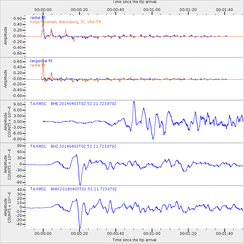
Signal To Noise
| Channel | StoN | STA | LTA |
| TA:KMSC: :BHZ:20140403T02:52:21.723979Z | 3.1771402 | 1.0914653E-6 | 3.43537E-7 |
| TA:KMSC: :BHN:20140403T02:52:21.723979Z | 3.1560683 | 8.549885E-7 | 2.7090306E-7 |
| TA:KMSC: :BHE:20140403T02:52:21.723979Z | 1.1720312 | 4.2154807E-7 | 3.5967307E-7 |
| Arrivals |
| Ps | 4.6 SECOND |
| PpPs | 12 SECOND |
| PsPs/PpSs | 17 SECOND |


