You are here: Home > Network List > US - United States National Seismic Network Stations List
> Station MSO Missoula, Montana, USA > Earthquake Result Viewer
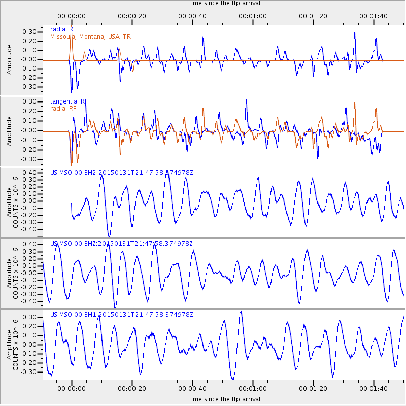
MSO Missoula, Montana, USA - Earthquake Result Viewer
*The percent match for this event was below the threshold and hence no stack was calculated.
| Earthquake location: |
Kermadec Islands Region |
| Earthquake latitude/longitude: |
-31.5/-177.8 |
| Earthquake time(UTC): |
2015/01/31 (031) 21:35:02 GMT |
| Earthquake Depth: |
35 km |
| Earthquake Magnitude: |
4.9 mb, 5.0 mb, 4.1 MS |
| Earthquake Catalog/Contributor: |
ISC/ISC |
|
| Network: |
US United States National Seismic Network |
| Station: |
MSO Missoula, Montana, USA |
| Lat/Lon: |
46.83 N/113.94 W |
| Elevation: |
1264 m |
|
| Distance: |
96.9 deg |
| Az: |
38.383 deg |
| Baz: |
230.552 deg |
| Ray Param: |
$rayparam |
*The percent match for this event was below the threshold and hence was not used in the summary stack. |
|
| Radial Match: |
40.130207 % |
| Radial Bump: |
400 |
| Transverse Match: |
59.955082 % |
| Transverse Bump: |
400 |
| SOD ConfigId: |
6962031 |
| Insert Time: |
2019-04-16 08:20:14.215 +0000 |
| GWidth: |
2.5 |
| Max Bumps: |
400 |
| Tol: |
0.001 |
|
Signal To Noise
| Channel | StoN | STA | LTA |
| US:MSO:00:BHZ:20150131T21:47:58.374978Z | 0.8388483 | 1.5636456E-7 | 1.8640387E-7 |
| US:MSO:00:BH1:20150131T21:47:58.374978Z | 0.66913986 | 1.697497E-7 | 2.5368342E-7 |
| US:MSO:00:BH2:20150131T21:47:58.374978Z | 1.5053455 | 2.792224E-7 | 1.8548725E-7 |
| Arrivals |
| Ps | |
| PpPs | |
| PsPs/PpSs | |


