You are here: Home > Network List > TA - USArray Transportable Network (new EarthScope stations) Stations List
> Station K48A Perry, MI, USA > Earthquake Result Viewer
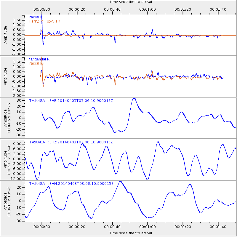
K48A Perry, MI, USA - Earthquake Result Viewer
*The percent match for this event was below the threshold and hence no stack was calculated.
| Earthquake location: |
Near Coast Of Northern Chile |
| Earthquake latitude/longitude: |
-20.7/-70.6 |
| Earthquake time(UTC): |
2014/04/03 (093) 02:56:06 GMT |
| Earthquake Depth: |
17 km |
| Earthquake Magnitude: |
5.6 MB |
| Earthquake Catalog/Contributor: |
NEIC PDE/NEIC COMCAT |
|
| Network: |
TA USArray Transportable Network (new EarthScope stations) |
| Station: |
K48A Perry, MI, USA |
| Lat/Lon: |
42.80 N/84.12 W |
| Elevation: |
273 m |
|
| Distance: |
64.4 deg |
| Az: |
348.989 deg |
| Baz: |
165.941 deg |
| Ray Param: |
$rayparam |
*The percent match for this event was below the threshold and hence was not used in the summary stack. |
|
| Radial Match: |
34.527336 % |
| Radial Bump: |
400 |
| Transverse Match: |
62.53235 % |
| Transverse Bump: |
400 |
| SOD ConfigId: |
626651 |
| Insert Time: |
2014-04-22 05:40:04.145 +0000 |
| GWidth: |
2.5 |
| Max Bumps: |
400 |
| Tol: |
0.001 |
|
Signal To Noise
| Channel | StoN | STA | LTA |
| TA:K48A: :BHZ:20140403T03:06:10.900015Z | 0.64883816 | 3.585333E-6 | 5.5257738E-6 |
| TA:K48A: :BHN:20140403T03:06:10.900015Z | 1.9063193 | 1.9421963E-5 | 1.0188201E-5 |
| TA:K48A: :BHE:20140403T03:06:10.900015Z | 1.3736489 | 1.0285431E-5 | 7.487671E-6 |
| Arrivals |
| Ps | |
| PpPs | |
| PsPs/PpSs | |


