You are here: Home > Network List > US - United States National Seismic Network Stations List
> Station MNTX Cornudas Mountains, Texas, USA > Earthquake Result Viewer
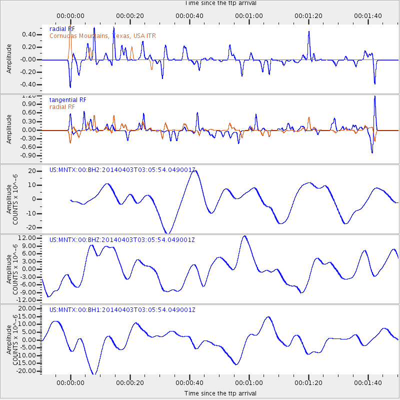
MNTX Cornudas Mountains, Texas, USA - Earthquake Result Viewer
*The percent match for this event was below the threshold and hence no stack was calculated.
| Earthquake location: |
Near Coast Of Northern Chile |
| Earthquake latitude/longitude: |
-20.7/-70.6 |
| Earthquake time(UTC): |
2014/04/03 (093) 02:56:06 GMT |
| Earthquake Depth: |
17 km |
| Earthquake Magnitude: |
5.6 MB |
| Earthquake Catalog/Contributor: |
NEIC PDE/NEIC COMCAT |
|
| Network: |
US United States National Seismic Network |
| Station: |
MNTX Cornudas Mountains, Texas, USA |
| Lat/Lon: |
31.70 N/105.38 W |
| Elevation: |
404 m |
|
| Distance: |
61.9 deg |
| Az: |
326.525 deg |
| Baz: |
142.719 deg |
| Ray Param: |
$rayparam |
*The percent match for this event was below the threshold and hence was not used in the summary stack. |
|
| Radial Match: |
56.49658 % |
| Radial Bump: |
391 |
| Transverse Match: |
55.481655 % |
| Transverse Bump: |
400 |
| SOD ConfigId: |
626651 |
| Insert Time: |
2014-04-22 05:51:22.037 +0000 |
| GWidth: |
2.5 |
| Max Bumps: |
400 |
| Tol: |
0.001 |
|
Signal To Noise
| Channel | StoN | STA | LTA |
| US:MNTX:00:BHZ:20140403T03:05:54.049001Z | 1.0907061 | 5.274673E-6 | 4.836017E-6 |
| US:MNTX:00:BH1:20140403T03:05:54.049001Z | 1.2070364 | 4.743164E-6 | 3.929595E-6 |
| US:MNTX:00:BH2:20140403T03:05:54.049001Z | 4.833646 | 2.0488302E-5 | 4.238685E-6 |
| Arrivals |
| Ps | |
| PpPs | |
| PsPs/PpSs | |


