You are here: Home > Network List > US - United States National Seismic Network Stations List
> Station WMOK Wichita Mountains, Oklahoma, USA > Earthquake Result Viewer
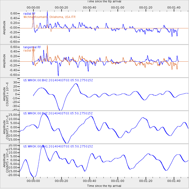
WMOK Wichita Mountains, Oklahoma, USA - Earthquake Result Viewer
*The percent match for this event was below the threshold and hence no stack was calculated.
| Earthquake location: |
Near Coast Of Northern Chile |
| Earthquake latitude/longitude: |
-20.7/-70.6 |
| Earthquake time(UTC): |
2014/04/03 (093) 02:56:06 GMT |
| Earthquake Depth: |
17 km |
| Earthquake Magnitude: |
5.6 MB |
| Earthquake Catalog/Contributor: |
NEIC PDE/NEIC COMCAT |
|
| Network: |
US United States National Seismic Network |
| Station: |
WMOK Wichita Mountains, Oklahoma, USA |
| Lat/Lon: |
34.74 N/98.78 W |
| Elevation: |
486 m |
|
| Distance: |
61.3 deg |
| Az: |
333.668 deg |
| Baz: |
149.722 deg |
| Ray Param: |
$rayparam |
*The percent match for this event was below the threshold and hence was not used in the summary stack. |
|
| Radial Match: |
43.485394 % |
| Radial Bump: |
400 |
| Transverse Match: |
49.89348 % |
| Transverse Bump: |
344 |
| SOD ConfigId: |
626651 |
| Insert Time: |
2014-04-22 05:51:56.208 +0000 |
| GWidth: |
2.5 |
| Max Bumps: |
400 |
| Tol: |
0.001 |
|
Signal To Noise
| Channel | StoN | STA | LTA |
| US:WMOK:00:BHZ:20140403T03:05:50.275015Z | 0.8214124 | 5.094196E-6 | 6.201752E-6 |
| US:WMOK:00:BH1:20140403T03:05:50.275015Z | 1.6572595 | 1.827556E-5 | 1.1027578E-5 |
| US:WMOK:00:BH2:20140403T03:05:50.275015Z | 1.3148025 | 2.3358678E-5 | 1.7765922E-5 |
| Arrivals |
| Ps | |
| PpPs | |
| PsPs/PpSs | |


