You are here: Home > Network List > UW - Pacific Northwest Regional Seismic Network Stations List
> Station MRBL Marblemount, WA, USA > Earthquake Result Viewer
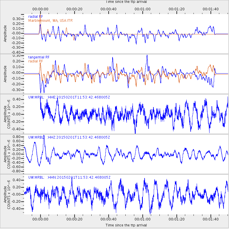
MRBL Marblemount, WA, USA - Earthquake Result Viewer
*The percent match for this event was below the threshold and hence no stack was calculated.
| Earthquake location: |
Santa Cruz Islands |
| Earthquake latitude/longitude: |
-12.4/166.8 |
| Earthquake time(UTC): |
2015/02/01 (032) 11:41:46 GMT |
| Earthquake Depth: |
179 km |
| Earthquake Magnitude: |
5.4 MW |
| Earthquake Catalog/Contributor: |
ISC/ISC |
|
| Network: |
UW Pacific Northwest Regional Seismic Network |
| Station: |
MRBL Marblemount, WA, USA |
| Lat/Lon: |
48.52 N/121.48 W |
| Elevation: |
75 m |
|
| Distance: |
87.5 deg |
| Az: |
39.191 deg |
| Baz: |
248.191 deg |
| Ray Param: |
$rayparam |
*The percent match for this event was below the threshold and hence was not used in the summary stack. |
|
| Radial Match: |
48.61921 % |
| Radial Bump: |
400 |
| Transverse Match: |
60.110275 % |
| Transverse Bump: |
400 |
| SOD ConfigId: |
6970591 |
| Insert Time: |
2019-04-16 09:37:02.844 +0000 |
| GWidth: |
2.5 |
| Max Bumps: |
400 |
| Tol: |
0.001 |
|
Signal To Noise
| Channel | StoN | STA | LTA |
| UW:MRBL: :HHZ:20150201T11:53:42.468005Z | 2.4782012 | 3.966986E-7 | 1.6007523E-7 |
| UW:MRBL: :HHN:20150201T11:53:42.468005Z | 0.76178294 | 9.2390955E-8 | 1.2128253E-7 |
| UW:MRBL: :HHE:20150201T11:53:42.468005Z | 0.55514246 | 8.397235E-8 | 1.5126271E-7 |
| Arrivals |
| Ps | |
| PpPs | |
| PsPs/PpSs | |


