You are here: Home > Network List > AZ - ANZA Regional Network Stations List
> Station SMER AZ.SMER > Earthquake Result Viewer
SMER AZ.SMER - Earthquake Result Viewer
*The percent match for this event was below the threshold and hence no stack was calculated.
| Earthquake location: |
Southeast Of Loyalty Islands |
| Earthquake latitude/longitude: |
-21.3/170.3 |
| Earthquake time(UTC): |
2015/02/01 (032) 13:34:07 GMT |
| Earthquake Depth: |
33 km |
| Earthquake Magnitude: |
5.8 MO |
| Earthquake Catalog/Contributor: |
NEIC PDE/NEIC ALERT |
|
| Network: |
AZ ANZA Regional Network |
| Station: |
SMER AZ.SMER |
| Lat/Lon: |
33.46 N/117.17 W |
| Elevation: |
355 m |
|
| Distance: |
87.9 deg |
| Az: |
52.928 deg |
| Baz: |
242.864 deg |
| Ray Param: |
$rayparam |
*The percent match for this event was below the threshold and hence was not used in the summary stack. |
|
| Radial Match: |
37.206387 % |
| Radial Bump: |
400 |
| Transverse Match: |
22.072475 % |
| Transverse Bump: |
400 |
| SOD ConfigId: |
6974671 |
| Insert Time: |
2019-04-16 09:49:30.249 +0000 |
| GWidth: |
2.5 |
| Max Bumps: |
400 |
| Tol: |
0.001 |
|
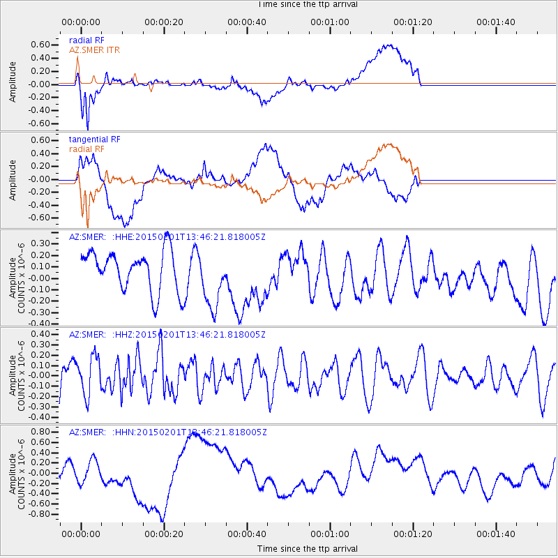
Signal To Noise
| Channel | StoN | STA | LTA |
| AZ:SMER: :HHZ:20150201T13:46:21.818005Z | 1.2388347 | 1.8774028E-7 | 1.5154586E-7 |
| AZ:SMER: :HHN:20150201T13:46:21.818005Z | 1.2239572 | 2.2595138E-7 | 1.8460726E-7 |
| AZ:SMER: :HHE:20150201T13:46:21.818005Z | 1.431627 | 2.566526E-7 | 1.7927339E-7 |
| Arrivals |
| Ps | |
| PpPs | |
| PsPs/PpSs | |


