You are here: Home > Network List > TA - USArray Transportable Network (new EarthScope stations) Stations List
> Station A21K Barrow, AK, USA > Earthquake Result Viewer
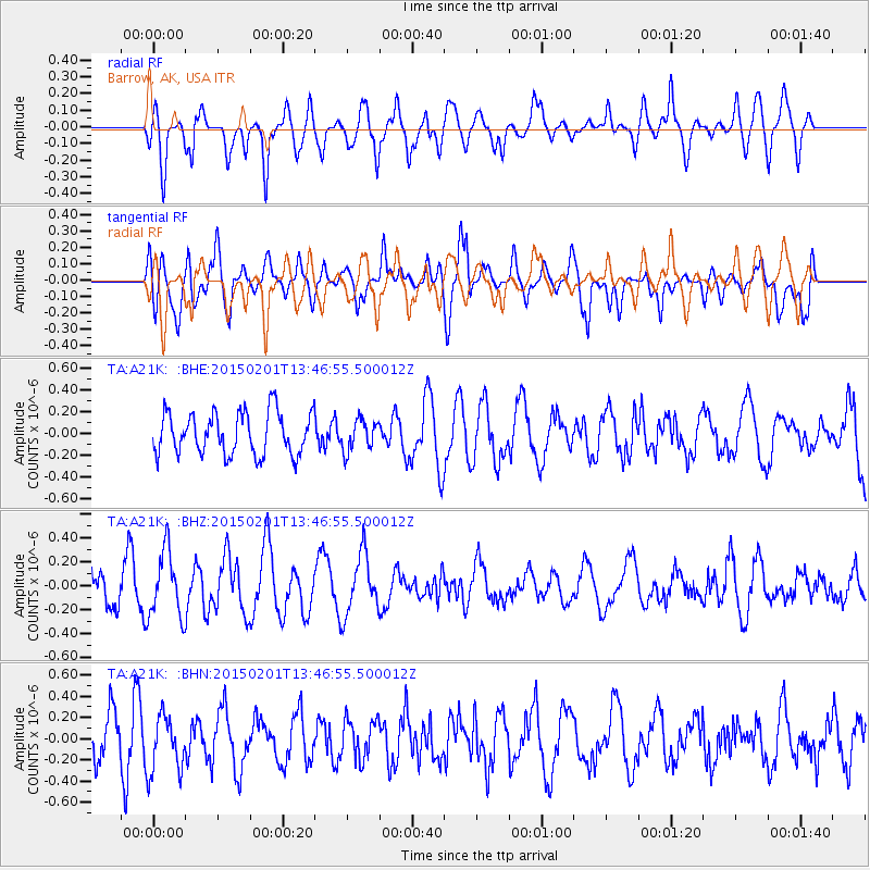
A21K Barrow, AK, USA - Earthquake Result Viewer
*The percent match for this event was below the threshold and hence no stack was calculated.
| Earthquake location: |
Southeast Of Loyalty Islands |
| Earthquake latitude/longitude: |
-21.3/170.3 |
| Earthquake time(UTC): |
2015/02/01 (032) 13:34:07 GMT |
| Earthquake Depth: |
33 km |
| Earthquake Magnitude: |
5.8 MO |
| Earthquake Catalog/Contributor: |
NEIC PDE/NEIC ALERT |
|
| Network: |
TA USArray Transportable Network (new EarthScope stations) |
| Station: |
A21K Barrow, AK, USA |
| Lat/Lon: |
71.32 N/156.62 W |
| Elevation: |
577 m |
|
| Distance: |
95.2 deg |
| Az: |
10.167 deg |
| Baz: |
210.722 deg |
| Ray Param: |
$rayparam |
*The percent match for this event was below the threshold and hence was not used in the summary stack. |
|
| Radial Match: |
53.524834 % |
| Radial Bump: |
400 |
| Transverse Match: |
56.613197 % |
| Transverse Bump: |
400 |
| SOD ConfigId: |
6974671 |
| Insert Time: |
2019-04-16 09:53:07.895 +0000 |
| GWidth: |
2.5 |
| Max Bumps: |
400 |
| Tol: |
0.001 |
|
Signal To Noise
| Channel | StoN | STA | LTA |
| TA:A21K: :BHZ:20150201T13:46:55.500012Z | 2.3606248 | 2.7512706E-7 | 1.16548414E-7 |
| TA:A21K: :BHN:20150201T13:46:55.500012Z | 1.2043761 | 2.6700556E-7 | 2.2169618E-7 |
| TA:A21K: :BHE:20150201T13:46:55.500012Z | 0.72162193 | 1.4079929E-7 | 1.9511502E-7 |
| Arrivals |
| Ps | |
| PpPs | |
| PsPs/PpSs | |


