You are here: Home > Network List > TA - USArray Transportable Network (new EarthScope stations) Stations List
> Station K48A Perry, MI, USA > Earthquake Result Viewer
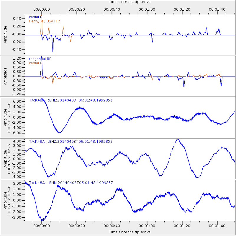
K48A Perry, MI, USA - Earthquake Result Viewer
*The percent match for this event was below the threshold and hence no stack was calculated.
| Earthquake location: |
Near Coast Of Northern Chile |
| Earthquake latitude/longitude: |
-20.8/-70.4 |
| Earthquake time(UTC): |
2014/04/03 (093) 05:51:44 GMT |
| Earthquake Depth: |
27 km |
| Earthquake Magnitude: |
5.5 MB, 5.3 MWR |
| Earthquake Catalog/Contributor: |
NEIC PDE/NEIC COMCAT |
|
| Network: |
TA USArray Transportable Network (new EarthScope stations) |
| Station: |
K48A Perry, MI, USA |
| Lat/Lon: |
42.80 N/84.12 W |
| Elevation: |
273 m |
|
| Distance: |
64.5 deg |
| Az: |
348.851 deg |
| Baz: |
165.768 deg |
| Ray Param: |
$rayparam |
*The percent match for this event was below the threshold and hence was not used in the summary stack. |
|
| Radial Match: |
82.74613 % |
| Radial Bump: |
395 |
| Transverse Match: |
56.878677 % |
| Transverse Bump: |
400 |
| SOD ConfigId: |
626651 |
| Insert Time: |
2014-04-22 08:28:00.591 +0000 |
| GWidth: |
2.5 |
| Max Bumps: |
400 |
| Tol: |
0.001 |
|
Signal To Noise
| Channel | StoN | STA | LTA |
| TA:K48A: :BHZ:20140403T06:01:48.199985Z | 1.7519683 | 2.9328846E-6 | 1.6740513E-6 |
| TA:K48A: :BHN:20140403T06:01:48.199985Z | 1.5613095 | 3.189737E-6 | 2.0429884E-6 |
| TA:K48A: :BHE:20140403T06:01:48.199985Z | 0.6639202 | 2.5721017E-6 | 3.8741127E-6 |
| Arrivals |
| Ps | |
| PpPs | |
| PsPs/PpSs | |


