You are here: Home > Network List > UW - Pacific Northwest Regional Seismic Network Stations List
> Station MRBL Marblemount, WA, USA > Earthquake Result Viewer
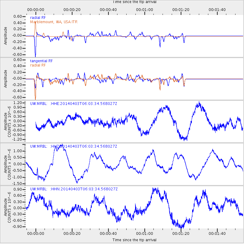
MRBL Marblemount, WA, USA - Earthquake Result Viewer
*The percent match for this event was below the threshold and hence no stack was calculated.
| Earthquake location: |
Near Coast Of Northern Chile |
| Earthquake latitude/longitude: |
-20.8/-70.4 |
| Earthquake time(UTC): |
2014/04/03 (093) 05:51:44 GMT |
| Earthquake Depth: |
27 km |
| Earthquake Magnitude: |
5.5 MB, 5.3 MWR |
| Earthquake Catalog/Contributor: |
NEIC PDE/NEIC COMCAT |
|
| Network: |
UW Pacific Northwest Regional Seismic Network |
| Station: |
MRBL Marblemount, WA, USA |
| Lat/Lon: |
48.52 N/121.48 W |
| Elevation: |
75 m |
|
| Distance: |
82.7 deg |
| Az: |
328.562 deg |
| Baz: |
132.77 deg |
| Ray Param: |
$rayparam |
*The percent match for this event was below the threshold and hence was not used in the summary stack. |
|
| Radial Match: |
57.495995 % |
| Radial Bump: |
400 |
| Transverse Match: |
63.701054 % |
| Transverse Bump: |
400 |
| SOD ConfigId: |
626651 |
| Insert Time: |
2014-04-22 08:39:21.496 +0000 |
| GWidth: |
2.5 |
| Max Bumps: |
400 |
| Tol: |
0.001 |
|
Signal To Noise
| Channel | StoN | STA | LTA |
| UW:MRBL: :HHZ:20140403T06:03:34.568027Z | 2.8368027 | 1.1139954E-6 | 3.92694E-7 |
| UW:MRBL: :HHN:20140403T06:03:34.568027Z | 2.8698165 | 6.560516E-7 | 2.2860401E-7 |
| UW:MRBL: :HHE:20140403T06:03:34.568027Z | 0.4922217 | 1.3877131E-7 | 2.819285E-7 |
| Arrivals |
| Ps | |
| PpPs | |
| PsPs/PpSs | |


