You are here: Home > Network List > TA - USArray Transportable Network (new EarthScope stations) Stations List
> Station G59A Clarenceville, QC, USA > Earthquake Result Viewer
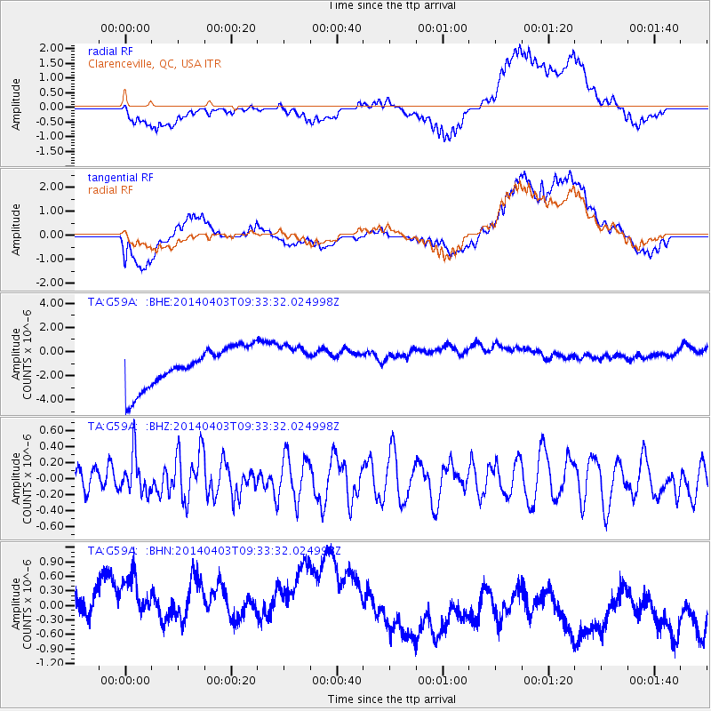
G59A Clarenceville, QC, USA - Earthquake Result Viewer
*The percent match for this event was below the threshold and hence no stack was calculated.
| Earthquake location: |
Near Coast Of Northern Chile |
| Earthquake latitude/longitude: |
-20.6/-70.7 |
| Earthquake time(UTC): |
2014/04/03 (093) 09:23:21 GMT |
| Earthquake Depth: |
15 km |
| Earthquake Magnitude: |
5.6 MB, 5.3 MWR |
| Earthquake Catalog/Contributor: |
NEIC PDE/NEIC COMCAT |
|
| Network: |
TA USArray Transportable Network (new EarthScope stations) |
| Station: |
G59A Clarenceville, QC, USA |
| Lat/Lon: |
45.08 N/73.18 W |
| Elevation: |
36 m |
|
| Distance: |
65.4 deg |
| Az: |
358.072 deg |
| Baz: |
177.45 deg |
| Ray Param: |
$rayparam |
*The percent match for this event was below the threshold and hence was not used in the summary stack. |
|
| Radial Match: |
47.948673 % |
| Radial Bump: |
400 |
| Transverse Match: |
62.999947 % |
| Transverse Bump: |
400 |
| SOD ConfigId: |
626651 |
| Insert Time: |
2014-04-22 09:05:38.775 +0000 |
| GWidth: |
2.5 |
| Max Bumps: |
400 |
| Tol: |
0.001 |
|
Signal To Noise
| Channel | StoN | STA | LTA |
| TA:G59A: :BHZ:20140403T09:33:32.024998Z | 1.2630934 | 2.3894697E-7 | 1.89176E-7 |
| TA:G59A: :BHN:20140403T09:33:32.024998Z | 1.2207344 | 1.8960374E-6 | 1.5531941E-6 |
| TA:G59A: :BHE:20140403T09:33:32.024998Z | 0.94755256 | 1.5408742E-6 | 1.6261622E-6 |
| Arrivals |
| Ps | |
| PpPs | |
| PsPs/PpSs | |


