You are here: Home > Network List > TA - USArray Transportable Network (new EarthScope stations) Stations List
> Station Q48A North Vernon, IN, USA > Earthquake Result Viewer
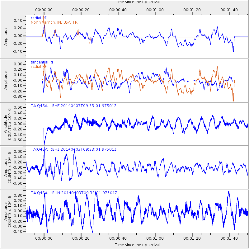
Q48A North Vernon, IN, USA - Earthquake Result Viewer
*The percent match for this event was below the threshold and hence no stack was calculated.
| Earthquake location: |
Near Coast Of Northern Chile |
| Earthquake latitude/longitude: |
-20.6/-70.7 |
| Earthquake time(UTC): |
2014/04/03 (093) 09:23:21 GMT |
| Earthquake Depth: |
15 km |
| Earthquake Magnitude: |
5.6 MB, 5.3 MWR |
| Earthquake Catalog/Contributor: |
NEIC PDE/NEIC COMCAT |
|
| Network: |
TA USArray Transportable Network (new EarthScope stations) |
| Station: |
Q48A North Vernon, IN, USA |
| Lat/Lon: |
38.93 N/85.73 W |
| Elevation: |
185 m |
|
| Distance: |
60.8 deg |
| Az: |
346.611 deg |
| Baz: |
163.847 deg |
| Ray Param: |
$rayparam |
*The percent match for this event was below the threshold and hence was not used in the summary stack. |
|
| Radial Match: |
43.349167 % |
| Radial Bump: |
400 |
| Transverse Match: |
48.953068 % |
| Transverse Bump: |
400 |
| SOD ConfigId: |
626651 |
| Insert Time: |
2014-04-22 09:10:57.507 +0000 |
| GWidth: |
2.5 |
| Max Bumps: |
400 |
| Tol: |
0.001 |
|
Signal To Noise
| Channel | StoN | STA | LTA |
| TA:Q48A: :BHZ:20140403T09:33:01.97501Z | 1.4645231 | 2.4922733E-7 | 1.7017643E-7 |
| TA:Q48A: :BHN:20140403T09:33:01.97501Z | 0.8680772 | 2.1789037E-7 | 2.5100346E-7 |
| TA:Q48A: :BHE:20140403T09:33:01.97501Z | 0.7773852 | 1.5330347E-7 | 1.97204E-7 |
| Arrivals |
| Ps | |
| PpPs | |
| PsPs/PpSs | |


