You are here: Home > Network List > TA - USArray Transportable Network (new EarthScope stations) Stations List
> Station J05D Fort Rock, OR, USA > Earthquake Result Viewer
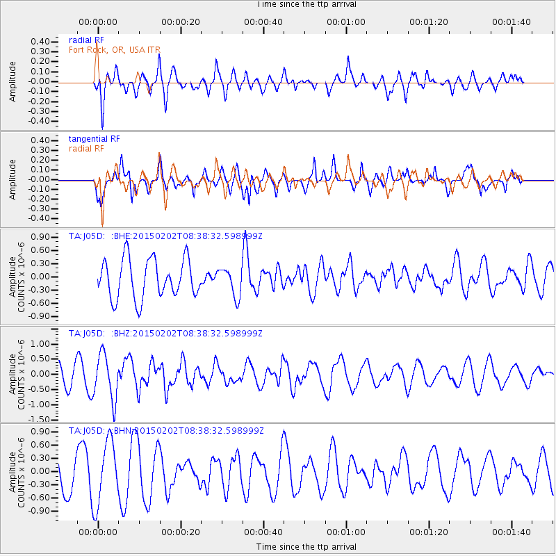
J05D Fort Rock, OR, USA - Earthquake Result Viewer
*The percent match for this event was below the threshold and hence no stack was calculated.
| Earthquake location: |
Admiralty Islands Region, P.N.G. |
| Earthquake latitude/longitude: |
-1.6/145.2 |
| Earthquake time(UTC): |
2015/02/02 (033) 08:25:48 GMT |
| Earthquake Depth: |
10 km |
| Earthquake Magnitude: |
5.9 MB |
| Earthquake Catalog/Contributor: |
NEIC PDE/NEIC COMCAT |
|
| Network: |
TA USArray Transportable Network (new EarthScope stations) |
| Station: |
J05D Fort Rock, OR, USA |
| Lat/Lon: |
43.28 N/121.23 W |
| Elevation: |
1541 m |
|
| Distance: |
93.7 deg |
| Az: |
46.913 deg |
| Baz: |
271.306 deg |
| Ray Param: |
$rayparam |
*The percent match for this event was below the threshold and hence was not used in the summary stack. |
|
| Radial Match: |
57.83559 % |
| Radial Bump: |
400 |
| Transverse Match: |
52.899155 % |
| Transverse Bump: |
400 |
| SOD ConfigId: |
6977071 |
| Insert Time: |
2019-04-16 10:37:58.878 +0000 |
| GWidth: |
2.5 |
| Max Bumps: |
400 |
| Tol: |
0.001 |
|
Signal To Noise
| Channel | StoN | STA | LTA |
| TA:J05D: :BHZ:20150202T08:38:32.598999Z | 2.1748981 | 7.5553163E-7 | 3.4738713E-7 |
| TA:J05D: :BHN:20150202T08:38:32.598999Z | 2.2081554 | 7.1659406E-7 | 3.2452155E-7 |
| TA:J05D: :BHE:20150202T08:38:32.598999Z | 0.78372 | 3.485959E-7 | 4.4479648E-7 |
| Arrivals |
| Ps | |
| PpPs | |
| PsPs/PpSs | |


