You are here: Home > Network List > TA - USArray Transportable Network (new EarthScope stations) Stations List
> Station O03E Paynes Creek, CA, USA > Earthquake Result Viewer
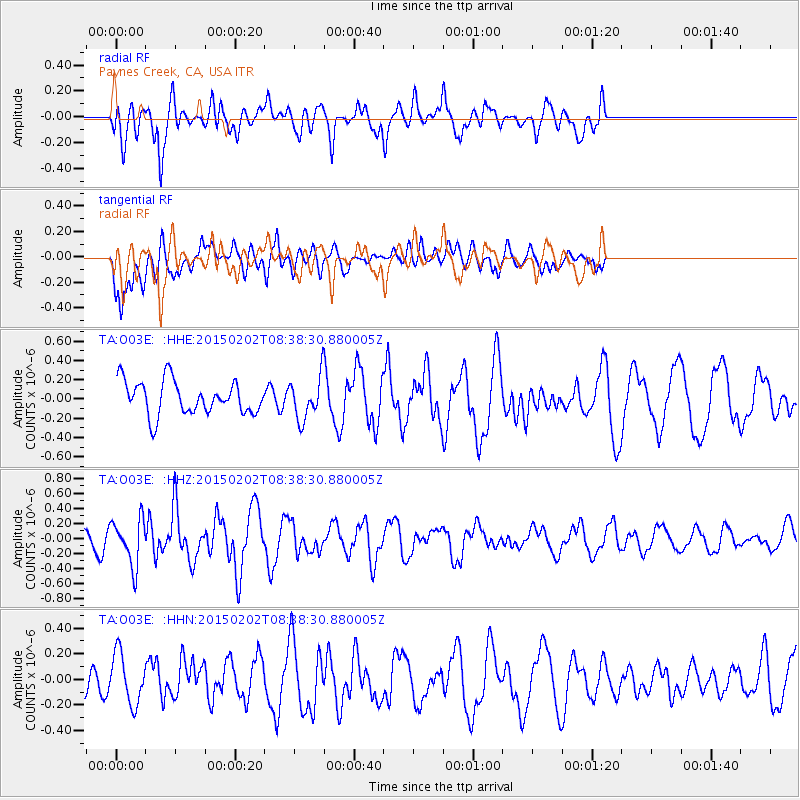
O03E Paynes Creek, CA, USA - Earthquake Result Viewer
*The percent match for this event was below the threshold and hence no stack was calculated.
| Earthquake location: |
Admiralty Islands Region, P.N.G. |
| Earthquake latitude/longitude: |
-1.6/145.2 |
| Earthquake time(UTC): |
2015/02/02 (033) 08:25:48 GMT |
| Earthquake Depth: |
10 km |
| Earthquake Magnitude: |
5.9 MB |
| Earthquake Catalog/Contributor: |
NEIC PDE/NEIC COMCAT |
|
| Network: |
TA USArray Transportable Network (new EarthScope stations) |
| Station: |
O03E Paynes Creek, CA, USA |
| Lat/Lon: |
40.29 N/121.80 W |
| Elevation: |
967 m |
|
| Distance: |
93.3 deg |
| Az: |
49.914 deg |
| Baz: |
270.748 deg |
| Ray Param: |
$rayparam |
*The percent match for this event was below the threshold and hence was not used in the summary stack. |
|
| Radial Match: |
75.58744 % |
| Radial Bump: |
400 |
| Transverse Match: |
56.982494 % |
| Transverse Bump: |
400 |
| SOD ConfigId: |
6977071 |
| Insert Time: |
2019-04-16 10:38:07.074 +0000 |
| GWidth: |
2.5 |
| Max Bumps: |
400 |
| Tol: |
0.001 |
|
Signal To Noise
| Channel | StoN | STA | LTA |
| TA:O03E: :HHZ:20150202T08:38:30.880005Z | 3.161458 | 3.0787993E-7 | 9.7385424E-8 |
| TA:O03E: :HHN:20150202T08:38:30.880005Z | 1.1714376 | 1.9868403E-7 | 1.69607E-7 |
| TA:O03E: :HHE:20150202T08:38:30.880005Z | 1.4271406 | 2.4553768E-7 | 1.720487E-7 |
| Arrivals |
| Ps | |
| PpPs | |
| PsPs/PpSs | |


