You are here: Home > Network List > UW - Pacific Northwest Regional Seismic Network Stations List
> Station PASS Maple Falls, WA, USA > Earthquake Result Viewer
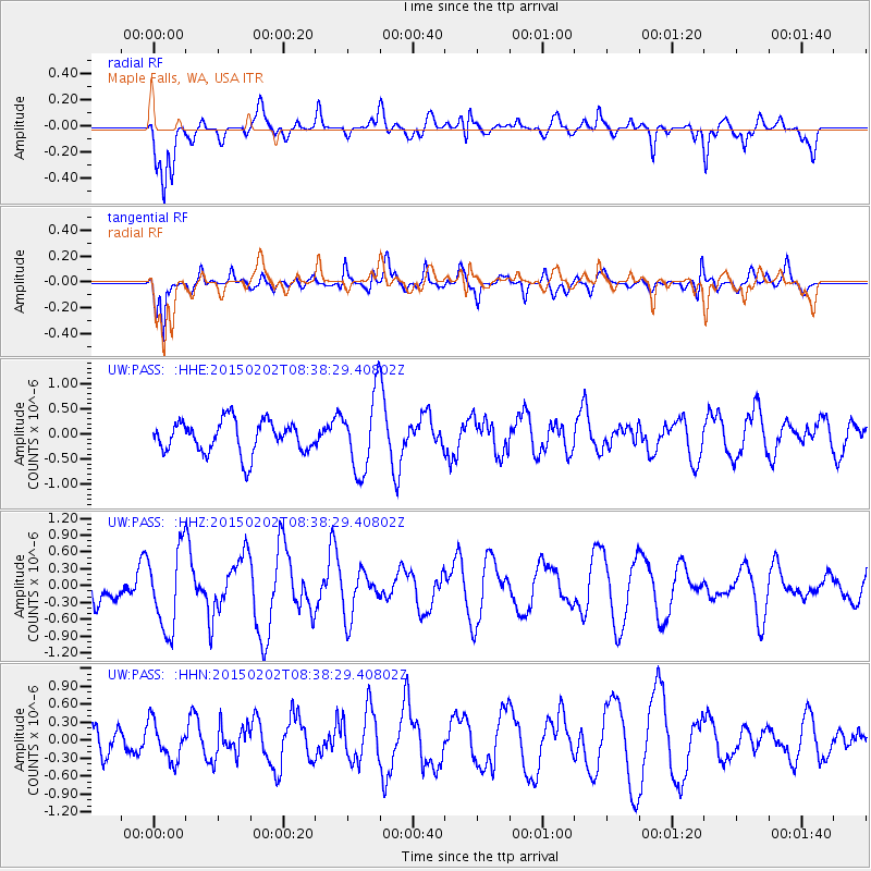
PASS Maple Falls, WA, USA - Earthquake Result Viewer
*The percent match for this event was below the threshold and hence no stack was calculated.
| Earthquake location: |
Admiralty Islands Region, P.N.G. |
| Earthquake latitude/longitude: |
-1.6/145.2 |
| Earthquake time(UTC): |
2015/02/02 (033) 08:25:48 GMT |
| Earthquake Depth: |
10 km |
| Earthquake Magnitude: |
5.9 MB |
| Earthquake Catalog/Contributor: |
NEIC PDE/NEIC COMCAT |
|
| Network: |
UW Pacific Northwest Regional Seismic Network |
| Station: |
PASS Maple Falls, WA, USA |
| Lat/Lon: |
49.00 N/122.09 W |
| Elevation: |
174 m |
|
| Distance: |
92.9 deg |
| Az: |
41.202 deg |
| Baz: |
271.023 deg |
| Ray Param: |
$rayparam |
*The percent match for this event was below the threshold and hence was not used in the summary stack. |
|
| Radial Match: |
64.05865 % |
| Radial Bump: |
400 |
| Transverse Match: |
70.82437 % |
| Transverse Bump: |
400 |
| SOD ConfigId: |
6977071 |
| Insert Time: |
2019-04-16 10:39:31.157 +0000 |
| GWidth: |
2.5 |
| Max Bumps: |
400 |
| Tol: |
0.001 |
|
Signal To Noise
| Channel | StoN | STA | LTA |
| UW:PASS: :HHZ:20150202T08:38:29.40802Z | 1.7660486 | 7.140774E-7 | 4.043362E-7 |
| UW:PASS: :HHN:20150202T08:38:29.40802Z | 1.3867412 | 3.1579174E-7 | 2.2772218E-7 |
| UW:PASS: :HHE:20150202T08:38:29.40802Z | 2.4388232 | 7.7689725E-7 | 3.1855413E-7 |
| Arrivals |
| Ps | |
| PpPs | |
| PsPs/PpSs | |


